- English
- Español
Integrated Water Resources Management
Past Projects
Publications
Integrated Watershed Management Practices for the Pantanal and Upper Paraguay River Basin
Background
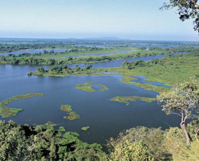
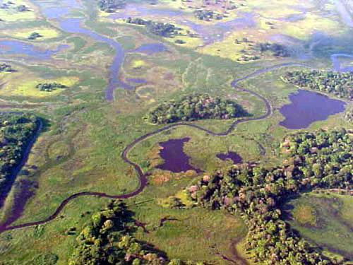
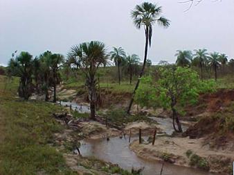
 The Paraguay River Basin, part of the La Plata River Basin, encompasses an area of 1,095,000 km2, straddling the borders of Brazil, Argentina, Bolivia, and Paraguay. The Upper Paraguay River Basin covers an area of approximately 600,000 km2, of which 362,376 km2 are in Brazil, encompassing large portions of the states of Mato Grosso and Mato Grosso do Sul. The Basin is of essential strategic importance within the context of water resources management in the countries that share it waters, which include Brazil, Bolivia, and Paraguay. The Basin comprises two distinct areas in which conditions vary significantly, both in terms of natural and water resources: the plateau (planalto) and the floodplain (pantanal), which is one of the largest wetland areas on the planet, covering 147,574 km2 and providing an essential link between the biomes of the Brazilian Cerrados, and the Chaco plains of Bolivia and Paraguay.
Highly seasonal rainfall patterns, nutrient-rich flooded areas, and extensive vegetation of more than 3,400 plant species, support rich and diverse wildlife habitats, as well as many endangered species such as the jaguar (Panthera onca). Also, waterfowl are abundant during the dry season.
Challenges
 Since 1970s, the Upper Paraguay River Basin has undergone significant socioeconomic development. The consequent intensive settlement patterns and land use, especially on the plateau, have had significant environmental impacts, including deforestation, land degradation, soil erosion, and siltation, water and environmental contamination, over-fishing, and incidence of invasive species, among others. Various planned large-scale infrastructure projects, with significant implications for the trans-border regions, also pose significant environmental threats to this Natural Heritage Area, Wetland of International Importance, and Biosphere Reserve.
In 1996, the Brazilian Government, through the Secretariat of Water Resources of the Ministry of Environment (SRH/MMA), requested technical and financial assistance from the GEF (Global Environment Facility), through UNEP (United Nations Environment Programme) (as the GEF Implementing Agency) and the OAS (in its capacity as the UNEP executing agency). The assistance was for the operationalization of the guidelines identified in the Upper Paraguay Basin Conservation Plan (PCBAB-original acronym is in Spanish) and for the preparation of an integrated management program for the Basin that would take into account its importance, its potential and its fragilities.
Various activities (or Sub-projects) were identified (listed in annex 9), including the preparation of a Diagnostic Analysis of the Basin (DAB) and a Strategic Action Program (SAP). These activities were carried out during from 2000-2003, and were structured within six components: (i) water quality and environmental protection; (ii) conservation of the Pantanal; (iii) prevention of land degradation; (iv) stakeholder involvement and sustainable development; (v) development of a governmental framework; and (vi) implementation of the Integrated Basin Management Program for the Upper Paraguay River Basin and the Pantanal.
Project Goals
 The main objective of the project is to promote the formulation and implementation of a Strategic Action Program (SAP) for the integrated management of the Pantanal and Upper Paraguay River Basin. Project activities are designed to enhance and provide protection to the environmental functioning of the predominant ecological system, protect the wetland biodiversity, and apply strategic activities that address the root causes of environmental degradation. The strengthening of basin institutions responsible for water resources management in the Basin, the generation and dissemination of information, and the integration of environmental concerns into economic development activities on a sustainable basis, are all key elements of this project.
During the process of drafting the Diagnostic Analysis of the Basin (DAB), and later during the SAP activities and the various public events held within the scope of the project, experiences were gained and lessons learned that will serve as useful references for subsequent projects. The most significant of these lessons are listed below:
- Activities carried out with clearly defined objectives contribute toward the building of a theoretical framework that can serve as a basis for strategic actions.
- Scientific contributions and technical parameters for the drafting of strategic actions and public policies are highly important.
- Research institutions and public policy managers should work together and exchange knowledge.
- There is a need for deeper knowledge on the dynamics of natural and social phenomena.
- Public participation generates tangible benefits in the process of drafting strategic actions.
- Inter-institutional articulation is of strategic nature.
- Conservation of biodiversity in the Upper Paraguay River Basin is directly related to the hydrological system.
- The SAP preparation process has proven a powerful participatory planning instrument.
Building upon the priority actions set forth in the SAP, the primary objective
of this project is to assist the governments of Argentina and Bolivia in
addressing the root causes of the principal environmental problems affecting the
Bermejo River Basin. The focus will be on their main transboundary
manifestations - namely, sediment erosion, transport, and deposition - and to
promote the sustainable development of the Bermejo River Binational Basin
(BRBB). Specific activities have been selected in order to catalyze the actions
of the SAP, including (i) the creation, restoration and protection of natural
vegetated areas; (ii) the conservation of aquatic and terrestrial habitat; (iii)
the support of widespread participation in the management of natural resources
through improved access to information and enhancement of public awareness; and
(iv) the control of water-borne contaminants. A key feature of this project will
be the replication and extension, throughout the Bermejo and Plata basins, of
the localized activities of the SAP formulation project that were determined to
be feasible measures for the integration of the geographic and demographic
aspects of watershed management within the BRBB.
The project design, based on extensive public consultation carried out through
regional planning workshops, comprises four components: (i) river basin and
coastal zone environmental analysis; (ii) public and stakeholder participation;
(iii) organizational structure development; and (iv) Watershed Management
Program formulation. In addition, the following crosscutting issues permeate the
project execution: information sharing and dissemination; quantification of
water use, use conflicts, and hydrological management; and financial mechanisms.
The project has been implemented in direct partnership with four Federal
institutions, three State bodies, four universities, and four NGOs, in the
context of institutional participation of more than 450 institutions.
Resources


