- English
- Español


Integrated Water Resources Management
Past Projects
Publications
Bermejo River Basin: Implementation of the Strategic Action Program for the Binational Basin of the Bermejo River
Background
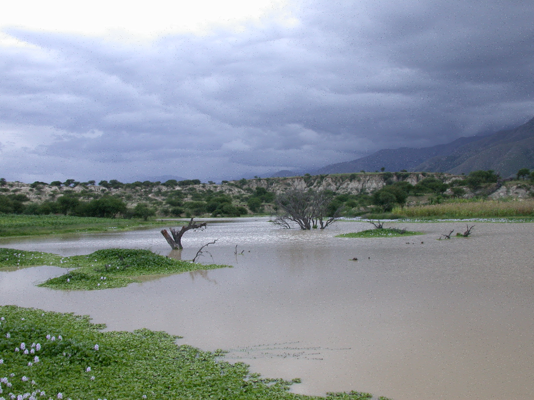
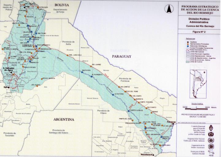
The Bermejo River Basin, located in southern South America, extends
over some 123,000 km², originating in the Andes Mountains of northwestern
Argentina and southern Bolivia. The river, which flows approximately 1,300 km,
links two major geographic features: the Andean Cordillera and the
Paraguay-Paraná Rivers. It is the only river that completely crosses the huge
expanse of the Chaco Plains, acting as a corridor for the connection of biotic
elements of both the Andean mountains and the Chaco Plains. Radically differing
weather and topographic conditions in the large basin promote an array of rain
forests, humid valleys, and mountain deserts in the Upper Basin and dry forests
as well as humid and gallery forests in the Lower Basin. There is exceptional
habitat diversity along the water course.
In 1995, the Binational Commission for the Upper Bermejo and Grande de Tarija
River basins requested GEF (Global Environment Facility) assistance for the
preparation of a water resources management program in the binational watershed.
This assistance helped with the preparation of a project proposal for the
formulation of a Strategic Action Program (SAP), seeking to solve the priority
transboundary environmental problems affecting the basin.
The Transboundary Diagnostic Analysis (TDA) and preparation of the SAP was
conducted between 1997 and 2000. Activities included the identification of
priority environmental concerns and related sectoral issues; the implementation
of pilot demonstration projects to assess the feasibility and relative costs of
specific remedial measures; and the establishment of a comprehensive public
participation and consultation process for the planning and implementation of
development projects in the basin.
Challenges
Sediment loadings in the Bermejo waters are some of the highest in the world (8
kg/m³). Total discharge of sediment is around 100 million tons/year. The greater
part of the sediment is produced in the Upper Basin and flushed down during peak
floods. The amount of sediment deposited along the course of the Lower Basin
during floods regularly changes the course of the river, impeding rational use
of water and land resources.
The population in the river basin is
estimated at 1.2 million, the majority being rural workers, small farmers, and
indigenous communities, with the lowest levels of income, education, and
sanitary conditions. The basin has a history of “extractive” exploitation of
forests, which has resulted in diminished biodiversity and impoverished natural
resources. The clearing of land for cultivation and widespread overgrazing have
created problems of erosion and desertification, aggravating sediment
mobilization that has contributed to downstream environmental degradation.
As identified in the TDA, the main environmental problems affecting the basin
include:
- Soil degradation
- Water resource degradation
- Water scarcity
- Biodiversity loss
- Floods and other natural hazard events
- Diminished quality of life and endangered cultural resources
Project Goals
The Strategic Action Program (SAP) put forth by both governments represents a
comprehensive 20-year, US$470 million proposal that seeks to address the major
environmental issues mentioned in the previous section and to promote
sustainable development of the basin. To help lay the groundwork and initiate
the implementation process, a small number of high priority actions were
selected from each program component, and subsequently approved for GEF
financing. Actions are grouped in four categories:
- Environmental protection and rehabilitation;
- Sustainable development of natural resources;
- Institutional development and strengthening;
- Public awareness and participation.
Building upon the priority actions set forth in the SAP, the primary objective
of this project is to assist the governments of Argentina and Bolivia in
addressing the root causes of the principal environmental problems affecting the
Bermejo River Basin. The focus will be on their main transboundary
manifestations - namely, sediment erosion, transport, and deposition - and to
promote the sustainable development of the Bermejo River Binational Basin
(BRBB). Specific activities have been selected in order to catalyze the actions
of the SAP, including (i) the creation, restoration and protection of natural
vegetated areas; (ii) the conservation of aquatic and terrestrial habitat; (iii)
the support of widespread participation in the management of natural resources
through improved access to information and enhancement of public awareness; and
(iv) the control of water-borne contaminants. A key feature of this project will
be the replication and extension, throughout the Bermejo and Plata basins, of
the localized activities of the SAP formulation project that were determined to
be feasible measures for the integration of the geographic and demographic
aspects of watershed management within the BRBB.
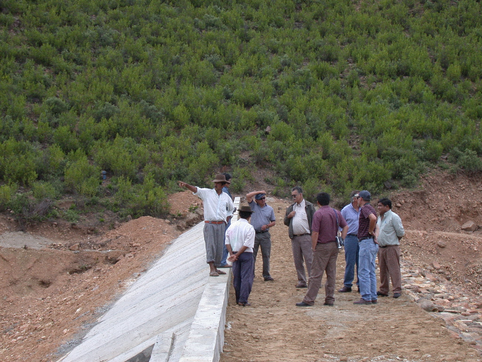
The project design, based on extensive public consultation carried out through
regional planning workshops, comprises four components: (i) river basin and
coastal zone environmental analysis; (ii) public and stakeholder participation;
(iii) organizational structure development; and (iv) Watershed Management
Program formulation. In addition, the following crosscutting issues permeate the
project execution: information sharing and dissemination; quantification of
water use, use conflicts, and hydrological management; and financial mechanisms.
The project has been implemented in direct partnership with four Federal
institutions, three State bodies, four universities, and four NGOs, in the
context of institutional participation of more than 450 institutions.
Location of the Project
Partners
- Implementing Agency: United Nations Environmental Programme (UNEP)
- Regional Executing Agency: Organization of American States/ Department of Sustainable Development
- Local Executing Agency: Binational Commission for the Development of the Upper Bermejo and Grande de Tarija River Basins
Resources