by Tony Gibbs, Director, CEP
Note: This paper was presented at the USAID/OAS PGDM building inspector training workshop, held in Antigua in January 2001. The figures referenced in this document can be viewed by selecting the individual links within the document or all together in a separate document.
The primary natural hazards facing the islands of the Caribbean are earthquakes and hurricanes. Some of the islands are also subjected to instances of volcanic activity. (This, however, is largely outside the scope of this paper.) There are also the related hazards of tsunamis and storm surge.
Torrential rains can also, by themselves, be considered natural hazards since they often occur without the concurrent occurrence of hurricanes and sometimes result in disastrous flooding of low-lying areas.
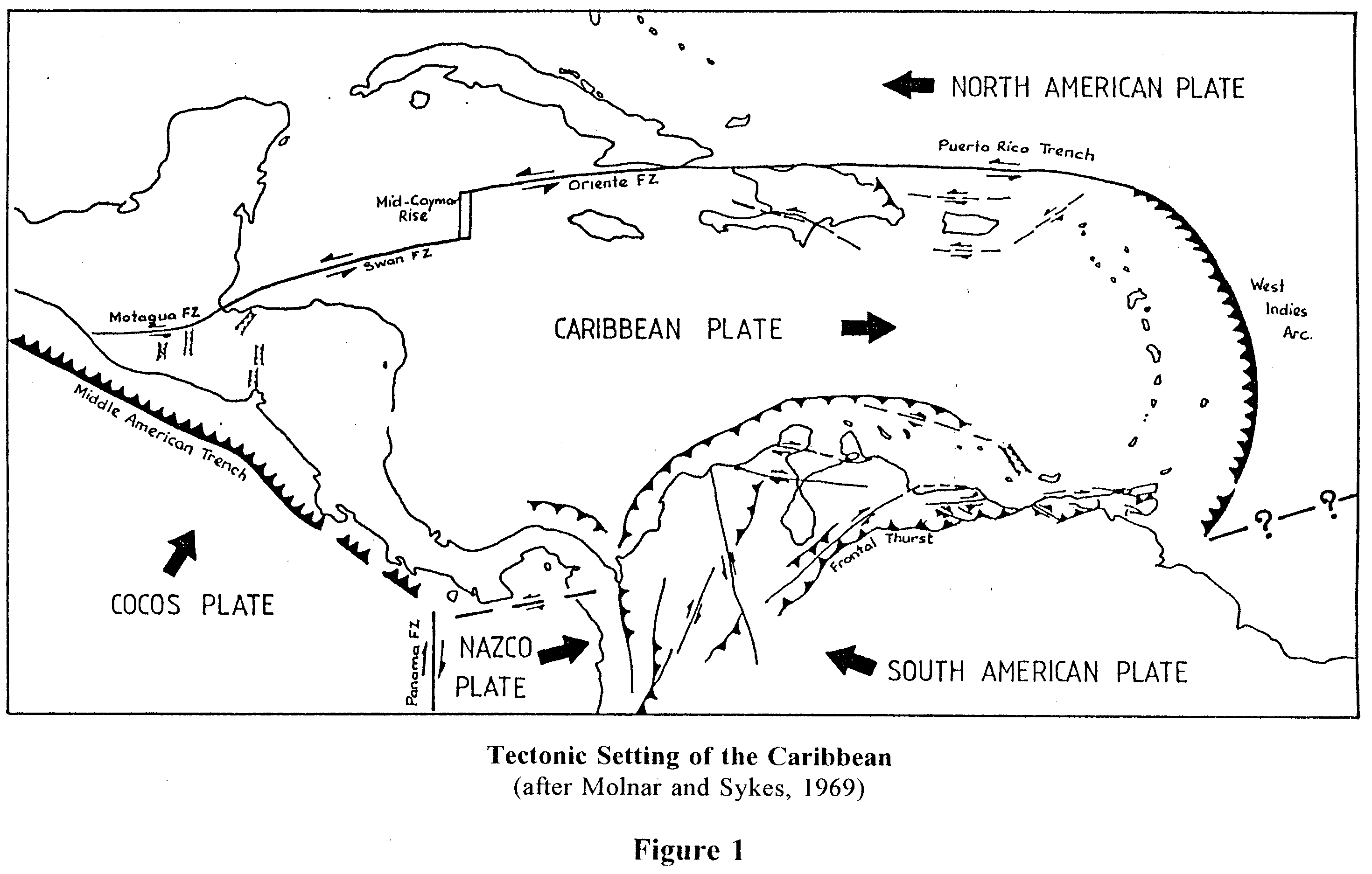
The Tectonic Setting of the Caribbean is illustrated in Figure 1. [Note: this is an oft-published document originally prepared by the researchers Molnar and Sykes in 1969.] It shows the Approximate Caribbean Plate Boundaries. As can be seen, all of the Commonwealth Caribbean countries, with the exceptions of Bahamas and Guyana, lie close to these boundaries. The Caribbean Plate is moving eastward with respect to the adjacent North American and South American Plates at a rate of approximately 20 millimetres (¾ inch) per year. A moderate level of inter-plate activity is generated along these boundaries. Along the northern margin, including areas in the vicinities of Jamaica and the Virgin Islands, moderate earthquakes of shallow depth are generated. Near the plate boundaries there are also intra-plate earthquakes. In the northern Caribbean these intra-plate earthquakes are caused by internal deformation in a slab of the North American Plate. Concentrations of these earthquakes occur at depths of up to 200 kilometres (125 miles).
Seismic events in the Eastern Caribbean are principally associated with a subduction zone at the junction of the Caribbean Plate and the North American Plate. The North American Plate dips from east to west beneath the Caribbean Plate along a north-south line just east of the main island arc. This leads to a moderate level of inter-plate seismicity. Superimposed on this is a pattern of intra-plate activity. There is a concentration of such activity in the Leeward Islands where the subduction of the Barracuda Rise imposes additional stresses on both the "subducted" North American Plate and the overriding Caribbean Plate. The earthquakes there are generally shallow. In the region north-west of Trinidad there is another concentration of earthquake activity where the strike of the plate boundary changes direction. These earthquakes are of intermediate depth.
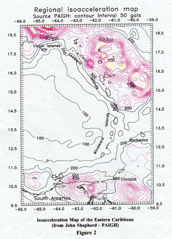
Over the past forty-seven years a considerable amount of research has been carried out on the seismicity of the Caribbean by the Seismic Research Unit (SRU) of The University of the West Indies (UWI). The engineering community has been requesting more and more assistance from the SRU in interpreting the fundamental research and developing "code" values for seismic forces for use in structural design. The most recent published work in this field is that of SRU's head, Dr John Shepherd.
The Pan-American Institute of Geography and History (PAIGH) is based in Mexico City. The Geophysical Commission of PAIGH was the executing agency for a major project (funded by the International Development Research Council of Canada, IDRC) for preparing Seismic Hazard Maps for Latin America and the Caribbean and headed by Dr J G Tanner. Dr John B Shepherd participated in this project as the Caribbean specialist. The final report and mapping from this project was issued in 1997. Some of the information is available on the Internet on the OAS site. Reproduced as Figure 2 is a regional iso-acceleration map for the Eastern Caribbean.
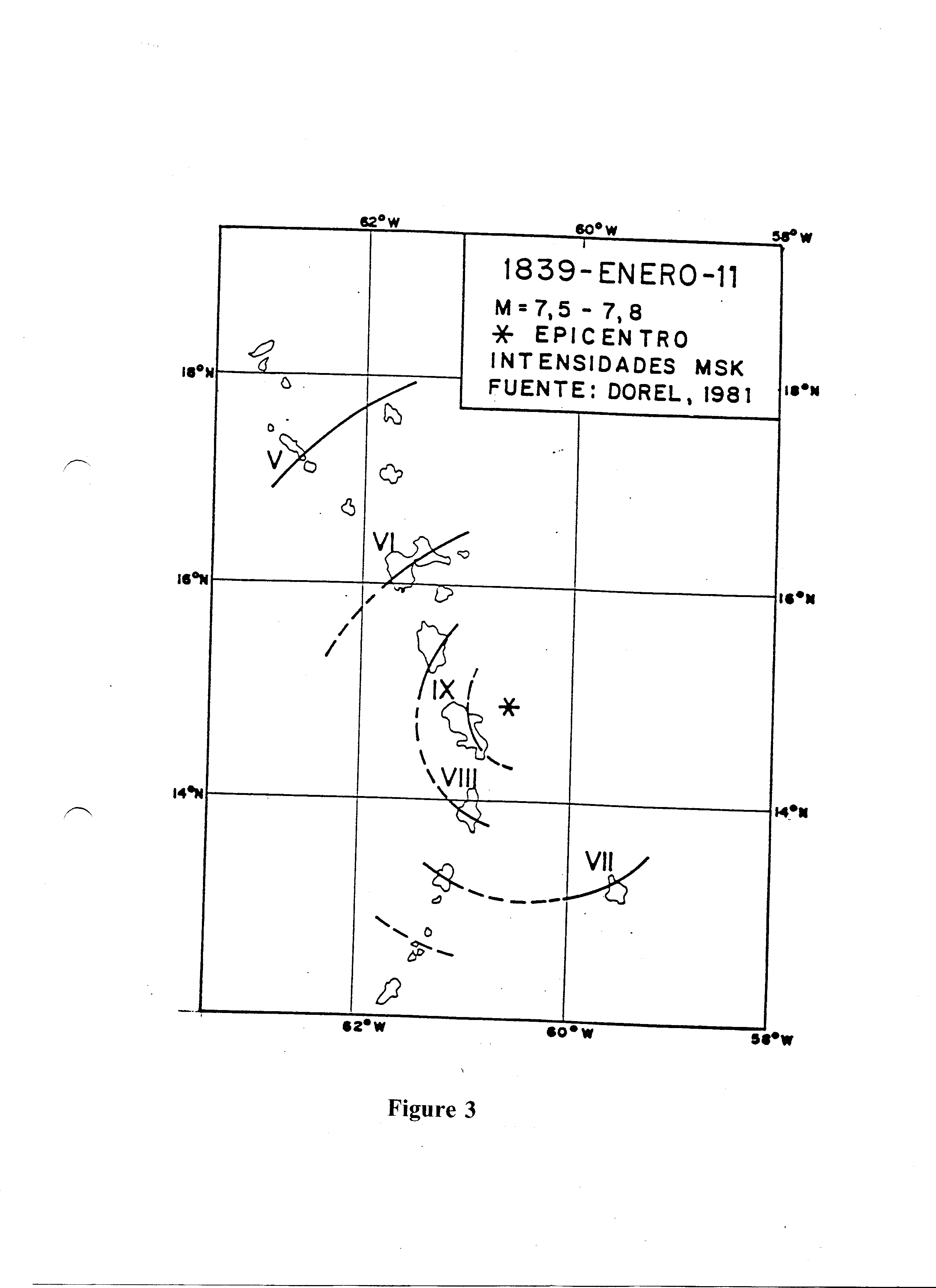
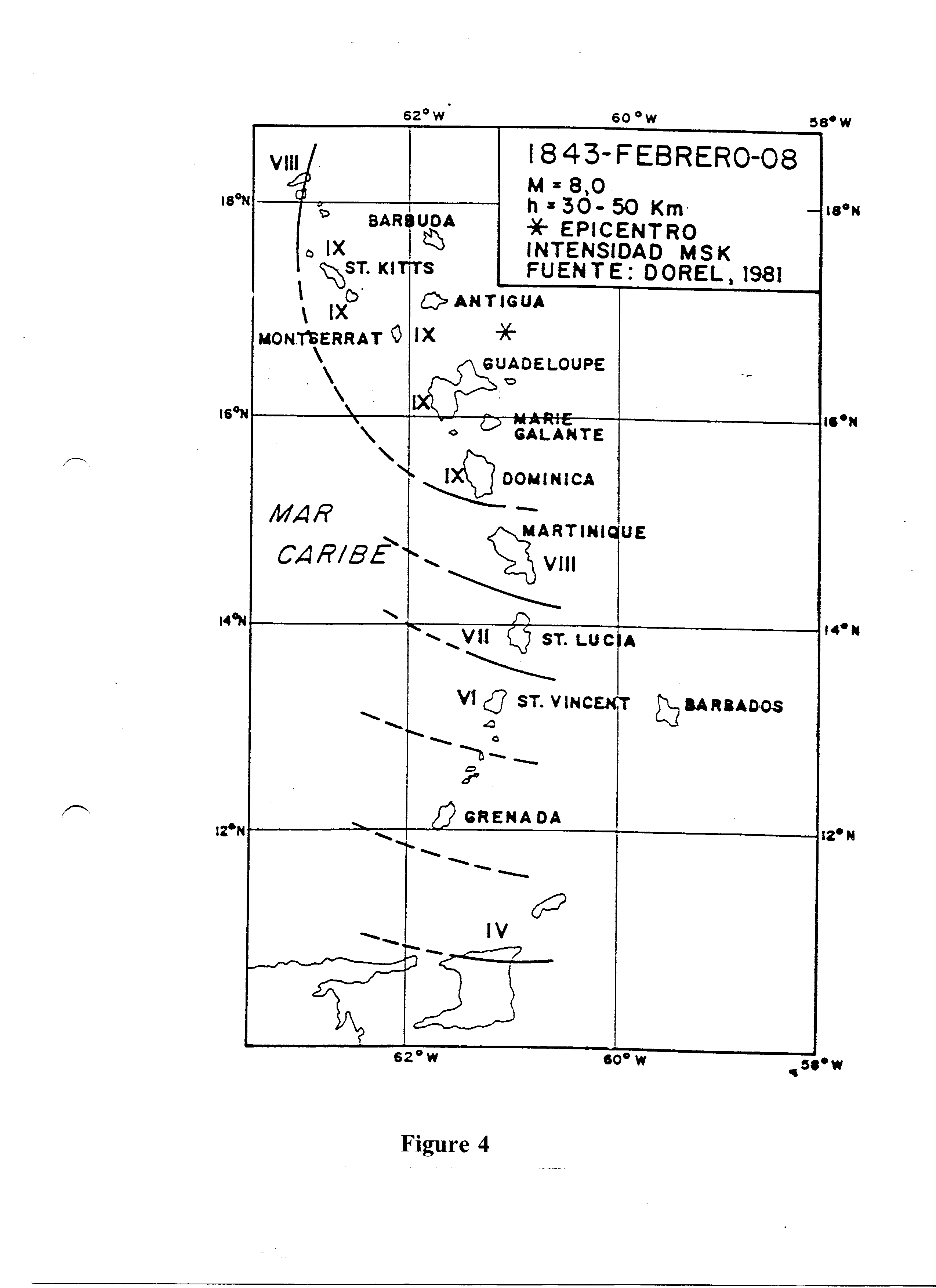
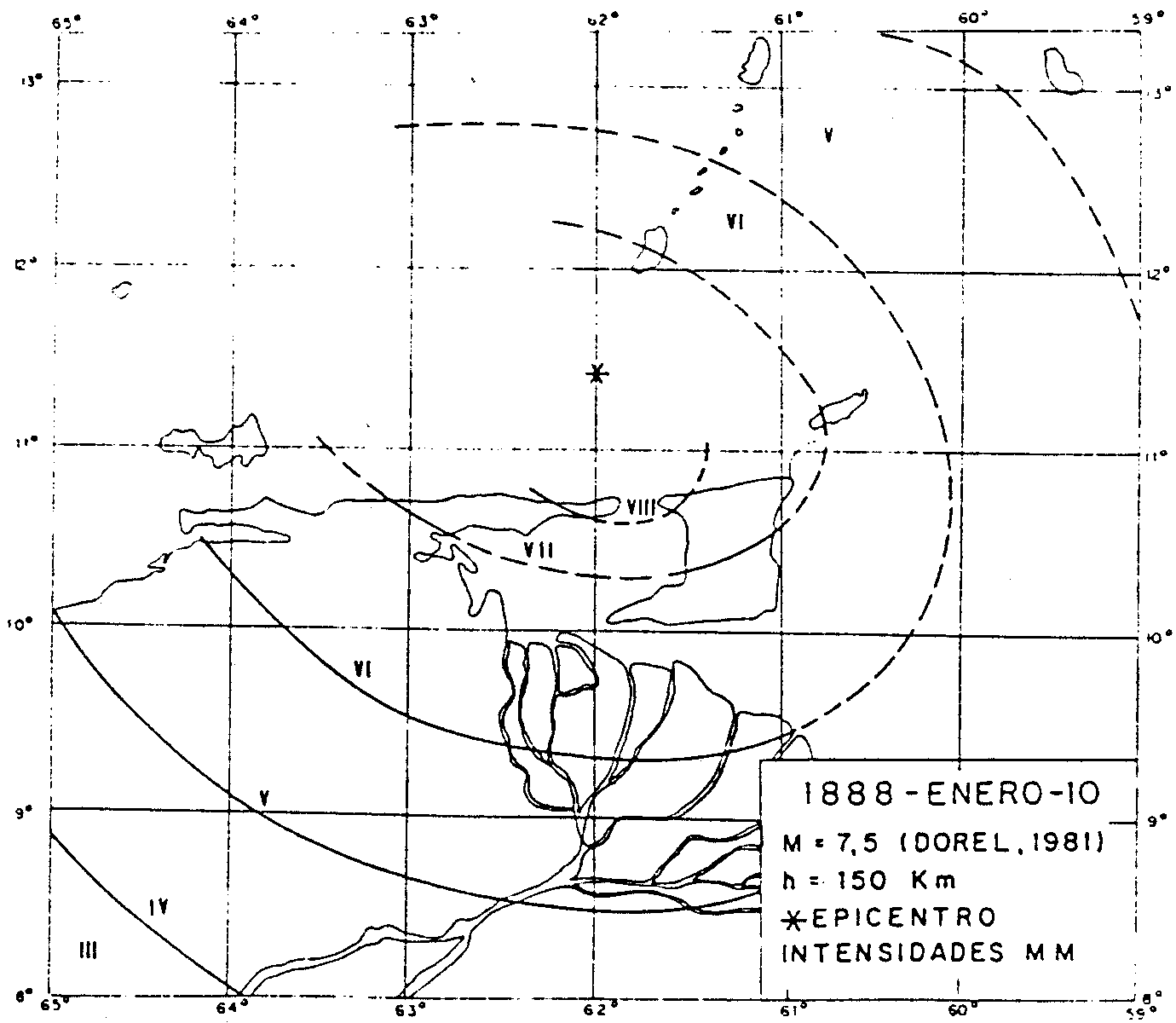
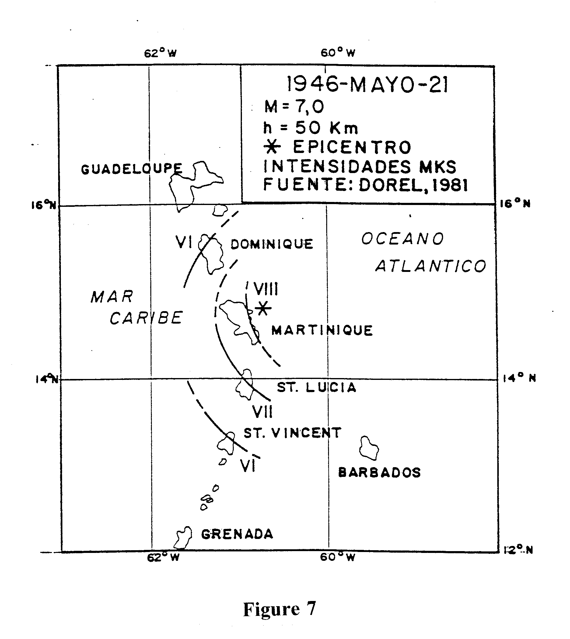
Several earthquakes have caused severe damage throughout the Caribbean archipelago in post-Columbian historic times. The seventeenth century earthquake in Jamaica and the nineteenth century earthquake in Guadeloupe are particularly well known. The researcher, Dorel, has constructed iso-seismal maps of several events of the nineteenth and twentieth centuries. Some of these are reproduced as Figures 3, 4, 5, 6, 7 and 8.
The level of seismicity in most of the Caribbean is considered to be moderate to severe. It is certainly sufficiently important not to be ignored.
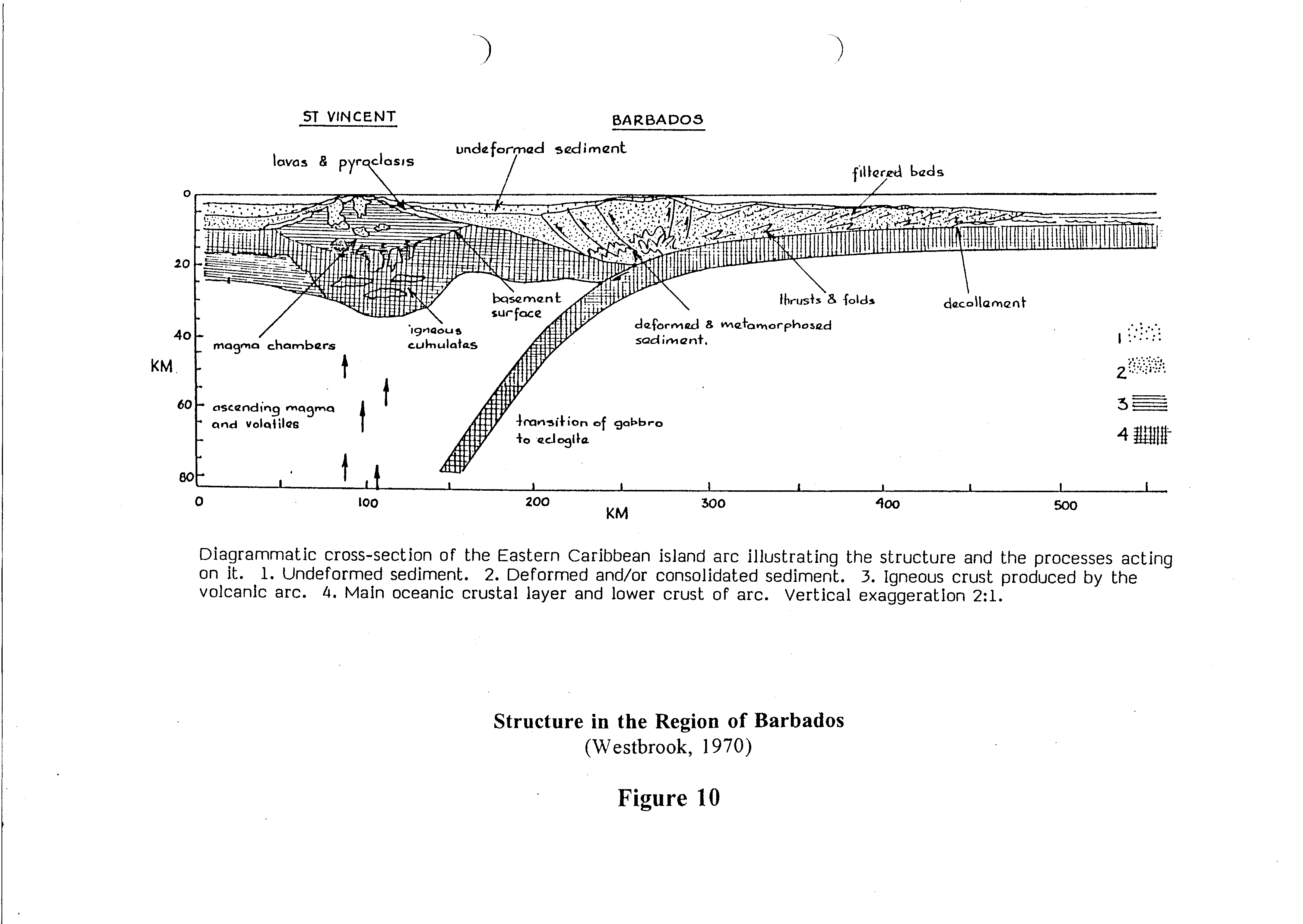
In addition to the figures mentioned above, Figure 9 shows the Main Features of the Eastern Caribbean and Figure 10 shows the structure in the region of Barbados.
[Based on information provided by Alfrico and Wayne Adams.] The earthquake of 13 January 1993 registered a magnitude of 5.4. The importance of the event was its epicentre being within Jamaica rather than offshore, where earthquakes were expected to occur in the vicinity of Jamaica. This earthquake epicentre was located in the Blue Mountain Structural Block less than 25 miles from the city of Kingston.
The event highlighted several unfavourable, but commonplace, design and construction issues. These included:
The estimated ground acceleration of 10% of gravity is much less than the design standard for Jamaica (30% g). No failure should occur at that level of ground shaking if the existing standards were followed.
[Based on information provided by Anthony Farrell.] In April 1997 there was a series of earth tremors of which the most serious were the magnitude 5.6 earthquake [20 miles NW of Scarborough at a depth of 3 miles] of 02 April and the magnitude 5.9 earthquake [10 miles from Scarborough at a depth of 3 miles] of 25 April.
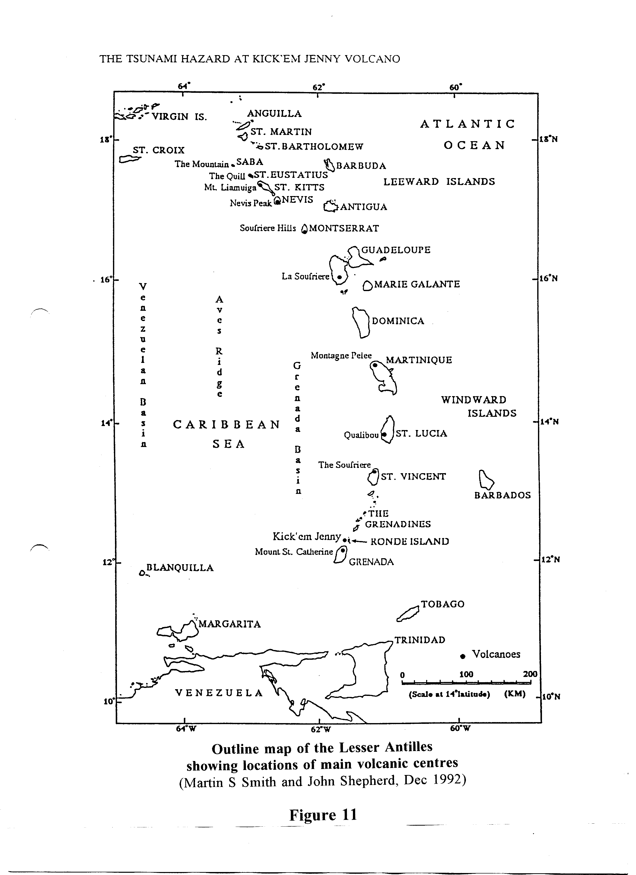
Several of the islands of the Eastern Caribbean are volcanic in origin. The volcanos there are considered to be either active or dormant. The principal locations of volcanic centres in the Lesser Antilles are shown in Figure 11.
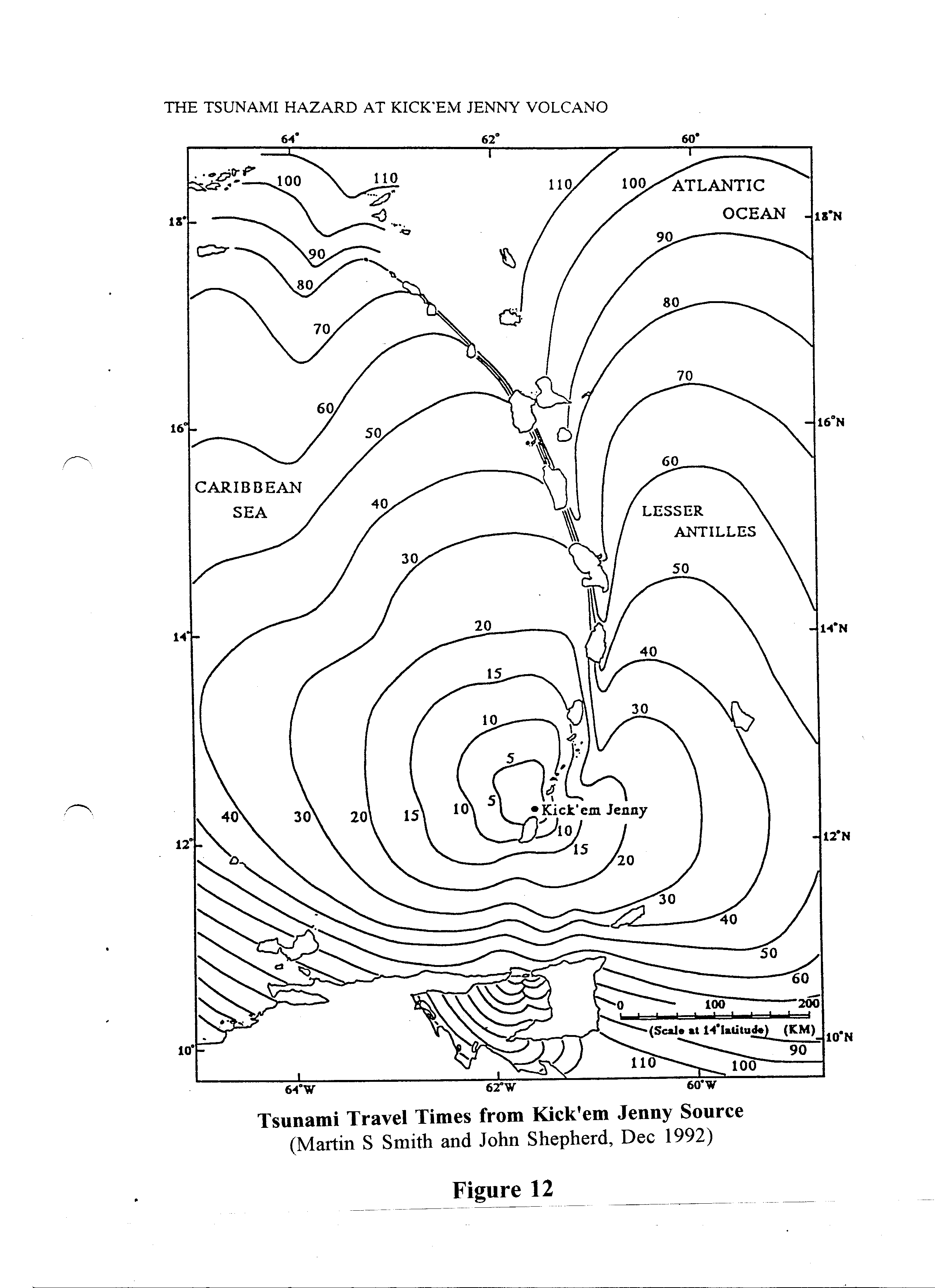
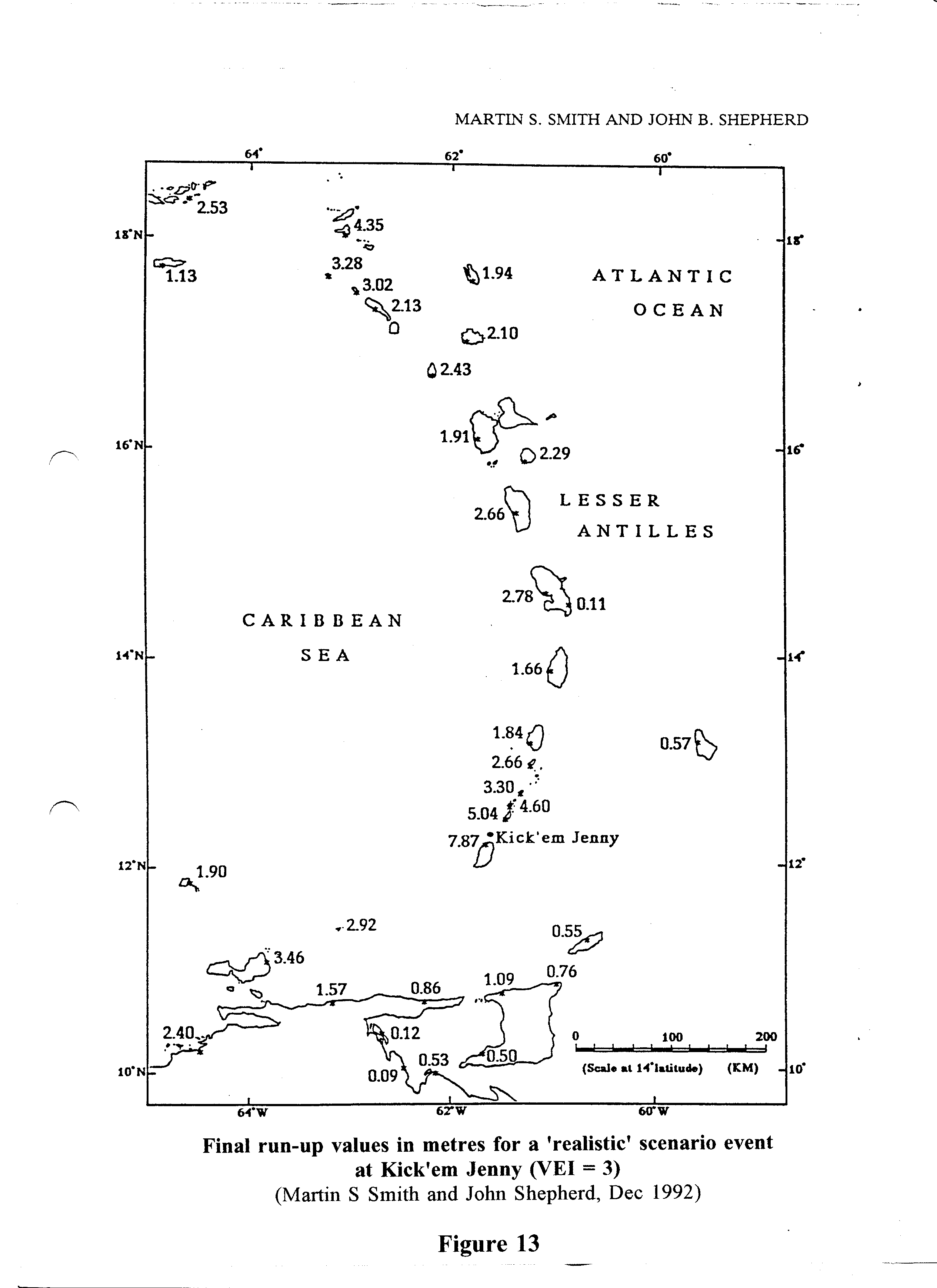
Grenada has the only known submarine volcano (Kick 'em Jenny) in the region. It is located just north of mainland Grenada. The first recorded eruption reportedly occurred in 1939. Studies dating back to 1972 indicate that minor eruptions have been occurring on a fairly regular basis and that the summit of the volcano is growing at a rate of approximately 4 metres (13 feet) per annum.
The potential hazard of Kick 'em Jenny to Grenada and the rest of the Eastern Caribbean lies in the form of tsunamis, should a major under-water volcanic eruption occur.
A tsunami (or seismic sea wave or tidal wave) is a series of ocean waves generated by any large-scale, short-duration disturbance of the free surface of the ocean. The majority are related to tectonic displacements associated with earthquakes at plate boundaries. However, tsunamis can also be generated by erupting volcanos, landslides or underwater explosions. In the open ocean, tsunamis may have wavelengths of up to several hundred miles but heights of less than 1 metre. Because this ratio is so large, tsunamis can go undetected until they approach shallow waters along a coast. Their height as they crash upon the shore mostly depends on the geometry of the submarine topography offshore, but they can be as high as 30 metres (100 feet).
A tsunami travels at an average velocity of 500 to 600 kilometres per hour (310 to 375 mph) rising to a maximum of 800 km/h (500 mph). Therefore within one hour of a major occurrence at Kick 'em Jenny, many of the islands of the Eastern Caribbean will be affected. Figure 12 indicates the travel times from Kick 'em Jenny and Figure 13 gives the wave heights at the various islands resulting from a "realistic" scenario for a volcanic event at Kick 'em Jenny.
[Note: a fuller account of this hazard is given in a separate paper at this PGDM workshop: Hurricanes and Their Effects on Buildings and Structures in the Caribbean.]
Much is not known about the storms which occurred in the Caribbean in the years before the advent of Columbus. But, of course, the European did not bring hurricanes to the Caribbean. Indeed the very name is derived from the Mayan storm god Hunraken and the Arawak word hurican, which meant the devil wind. The greatest of all recorded hurricanes occurred from 10 to 18 October 1780. Nearly 20,000 people perished as the storm hit virtually every island from Tobago in the south-east through the Windward and Leeward Islands and across to Hispaniola and Cuba. In the last 60 years in the Caribbean another 20,000 people have lost their lives because of hurricanes.
The Caribbean lies in the North Atlantic Ocean, one of the six main tropical areas of the Earth where hurricanes may develop every year. Within the 114 years between 1886 and 1999, approximately 1050 tropical storms have been recorded in the North Atlantic. About half of these attained hurricane strength.
The destructive potential of a hurricane is significant due to high wind speeds and torrential rains that produce flooding and occasional storm surge with heights of several feet above normal sea level.
The pattern in recent times has been a reduction of deaths and injuries (because of better warning systems and other preparedness activities) and an increase in property damage (because of commercially-driven unsuitable building practices and locations).
Although hurricanes are often accompanied by heavy rains, severe rainfall events resulting in flooding are also, and frequently, associated with troughs and tropical depressions. The risk of flooding is therefore not restricted to, nor more likely to occur, during hurricane events.
Drainage systems and structures in the Caribbean are generally designed for rainfall events having return periods of 20 years. This means that such systems are likely to become overloaded and cause some degree of flooding when rainstorms are experienced with return periods greater than 20 years.
Generally, lower lying areas will be more susceptible to flooding than higher and sloping ground.
The damage caused by flooding depends on the type and elevation of facilities in the location. The results of flooding may range from the inconvenience of temporarily submerged driveways to the loss of equipment and finishes inside flooded buildings and consequential disruption of the functions.
Flooding has been the cause of many of the deaths and of much property damage as well. Clearly location is critical when it comes to flood risk. Low-lying lands, river banks and lands adjacent to gullies are to be avoided if possible. If not, deliberate drainage measures must be taken. Usually this is a municipal responsibility, at least in terms of overall control, since what happens to one property can easily be affected by a neighbour's actions.
Storm surge is associated with hurricanes and consists of unusual volumes of water flowing onto shorelines. Storm surge has been responsible for much of the damage caused by hurricanes, especially in large, low-lying coastal settlements.
Storm surge is a complex phenomenon which behaves quite differently from one shoreline to another. The several main components governing their behaviour are:
These individual factors are combined in Figure 14. Also the storm-surge hazard for Belize is illustrated in Figure 15.
The increase in coastal settlement has put much of our economic investment in the hazardous coastal zone. Future rises in sea level can only make this condition more acute. Storm surge caused by hurricanes causes the most dramatic damage. (Waves cause damage without accompanying surge but they are also superimposed on storm surge.)
As well as causing flooding and damage to coastal structures, storm surge may also precipitate flooding further inland through the blockage of the outfalls of drainage systems.
| USAID/OAS Post-Georges Disaster Mitigation: http://www.oas.org/pgdm | Page last updated on 08 Jun 2001 |