Caribbean Disaster
Mitigation Project
Implemented by the Organization of American States
Unit of Sustainable Development and Environment
for the USAID Office of Foreign Disaster Assistance and the Caribbean Regional Program


Caribbean Disaster
Mitigation Project |
|
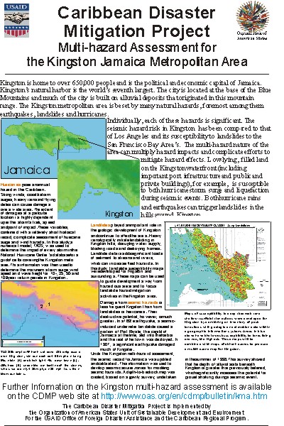
For a full description of the Kingston Multi-hazard Assessment, see the progress bulletin for this project.
These guidelines are presented in draft form, pending review, update and approval by appropriate Government of Jamaica Agencies and other interested parties in Jamaica.
Physical Planning Mechanism and Natural Hazards: a presentation by Blossom Samuels, Town Planning Department, Government of Jamaica.
ArcView shapefiles of data produced for the seismic hazard assessment. (.ZIP format, 500k)
* ESRI provides a free data viewer, ArcExplorer, on their web site. This viewer can be used to display various vector and point data formats (including those marked above): http://www.esri.com/base/products/arcexplorer/arcexplorer.html (~7mb)
** The topography/bathymetry database used for the coastal hazard assessment was developed by CDMP from the following sources:
The resulting database has a resolution of 6 arc-seconds and is optimized between 50 m below the surface and 200 m above sea level. Kingston harbour is protected by numerous reefs and sandbars, which may be below the resolution of this database and may, therefore, not be depicted appropriately.
CDMP made a poster presentation on the Kingston Multi-hazard Assessment at the Coastal GeoTools '99 conference, held in Charleston SC, April 5-7 1999.
| CDMP home page: http://www.oas.org/en/cdmp/ | Project Contacts | Page Last Updated: 20 April 2001 |