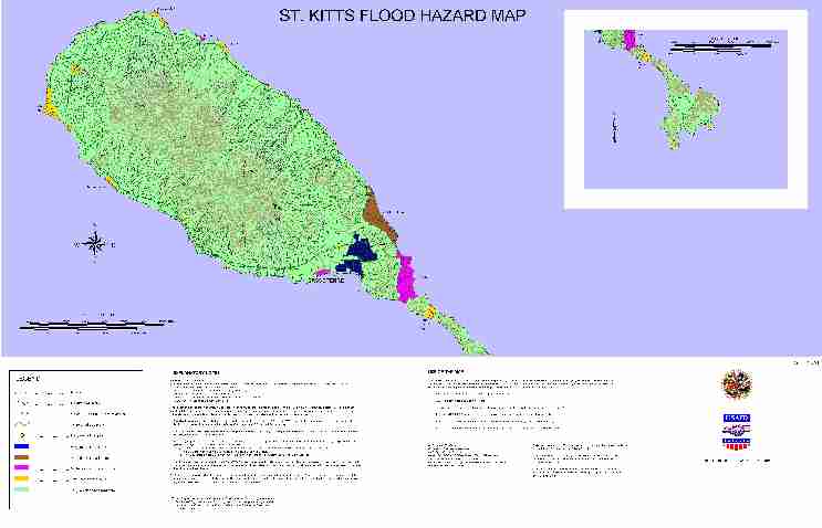
A higher resolution map image is also available (JPG 860k)
For the maximum 24 hour cumulative rainfall with a 100 year return period***, the mean water depth within hazard zones will be as follows:
Very high = exceeds 600 mm (about 2 feet).
High = between 300 mm and 600 mm (1 ft to 2 ft).
Moderate = between 150 mm and 300 mm (0.5 ft to 1ft).
Low = between 75 mm and 150 mm (3 inches to 6 inches).
Very low = less than 75 mm (3 inches).
This depth is a measure of the volume of water (from rainfall) running onto the zone from surrounding lands, after abstracting rainfall amounts due to infiltration and from natural land drainage. Since this is a mean value, there may be places within the zone that are not inundated, and other places (e.g., close to the drains and in depressions) where the water depth exceeds the mean value.
The flood prone zones were defined as ones with very small slopes (about 0.5% to 0.2%). Areas of the flood zones and the catchments draining into them were determined using ArcView Version 3.1 and 3D Analyst, Version 1.0.
Rainfall frequency was determined from an adequate database, consisting of twenty three years of continuous daily rainfall records from seven raingauges sited throughout the island.
Runoff hydrographs for the 100 year return storm were generated using the HEC-1 procedure developed by the U.S. Army Corps of Engineers (1990). The hydrographs were based on the following:
the Type III temporal distribution curve of the 24 hour rainfall produced by the National Resource Conservation Service, (formerly the Soils Conservation Service) United States.
a fully saturated watershed with water already on the ground from previous rainfall 24 hours earlier.
The topography was determined from a 1 in 50,000 contour map, and therefore could not include specific details of infrastructure such as road elevation, embankments, bridge and culvert openings, spillway details and reservoir sections, which are required for good estimates of drainage from the flood hazard zones
Drainage rates were estimated from field surveys and information contained in topographical maps. Drainage was considered restricted if the drains and streams at their outlets were (or there was a high probability that they could have been) blocked or limited by vegetation (mangroves) high sea water levels, or/and debris from within human settlements.
*** A 100 year return period storm has a 1/100 chance of occurring in any year. Storms with high return periods, though seldom occurring, have high rainfall amounts; small return period storms, which occur frequently, have small rainfall amounts.
The information for islandwide flooding was developed using an adequate rainfall database containing seven gauges located around the island, and therefore the derived daily extreme rainfall is likely to be good approximations, but owing to limitations in high resolution elevation data, the resulting map can only be considered preliminary. Nevertheless, it can be used for the following:
Ranking of areas on the island according to flood hazards.
Development of land use zoning plans.
Determination of areas for which detailed flood studies should be undertaken (or further developed).
The map MUST NOT be used for estimating water levels for various storm return periods.
The map DOES NOT provide any information about localized flooding due to flash flooding.
The map DOES NOT make any declaration of erosion hazard due to fast flowing water currents.
Grid: British West Indies
Projection: Transverse Mercator
Latitude of Origin: Equator
Longitude of Origin: 62 deg 00 min West of Greenwich
Scale factor on central meridian: 0.9995
False co-ordinates of Origin: 400 000 metres East, nil North
Unit of measurement: metre
Detailed surveys along Wash Ghaut and its surroundings were conducted by Dwight C. Francis Saddle Village St. Kitts.
Detailed surveys along College Street Ghaut and its surroundings were conducted by Anwar Deonanan and Associates, 3rd Street, Barataria, Trinidad, West Indies.
Controls points obtained from the Land and Surveys Department, St. Kitts/Nevis Government, were used for placing the survey data on the National Grid.
| USAID/OAS Post-Georges Disaster Mitigation: http://www.oas.org/pgdm | Page last updated on 14 May 2001 |