Produced by Watson Technical Consulting, Rincon GA
Note: All data used in this analysis was received via satellite directly from the National Weather Service via NOAAport feeds or direct from GEOS. Backup information was received via secondary satellite links and internet. The intervals listed refer to how often the data is received. The TAOS model runs use the most current information available at the time the run is made.
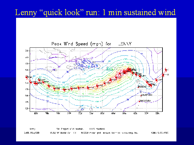
Note: This model run shows peak wind speeds over the life of the storm as calculated by TAOS. Storm positions and characteristics are based on information provided by the National Hurricane Center. "Quick Look" displays are produced immediately after the model run using GrADS. The quick look runs are used for the real time web based products.

| USAID/OAS Post-Georges Disaster Mitigation: http://www.oas.org/pgdm | Page last updated on 12 Feb 2001 |