
Report produced by the Caribbean Institute for Meteorology and Hydrology, December 1999.
As part of the agreement for real time runs, CIMH ran the TAOS model on November 17, 1999 as Lenny approached the Northeastern Caribbean from the west. At this time the system was forecast to move through the Virgin Islands and to the north of the Leeward Islands.
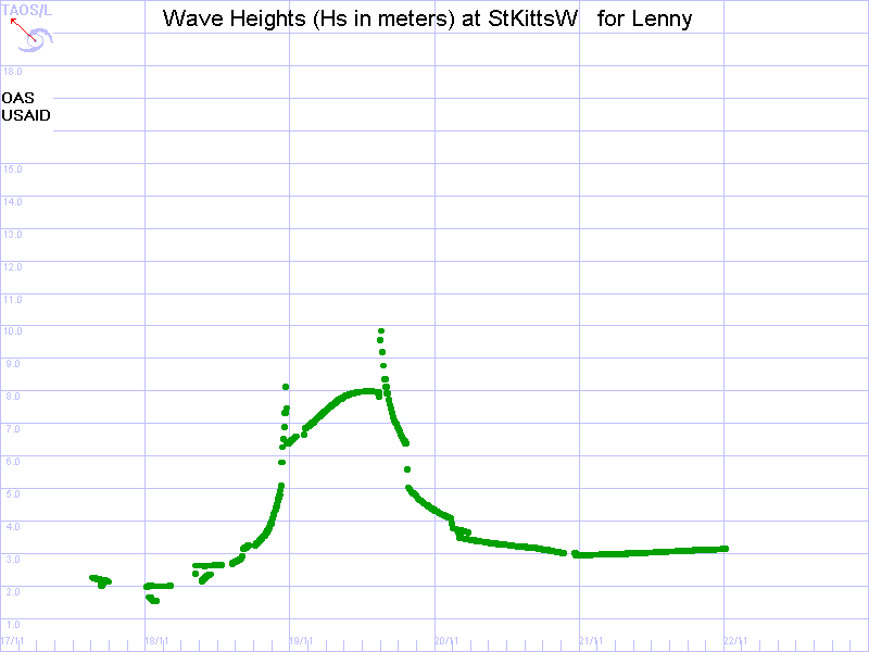
Predicted maximum storm surges over the Leeward Islands were of the order of two metres, similar to a westward moving storm of the same intensity from the MEOW runs. Wave heights of up to seven metres were being predicted by the model for some the Leeward Islands. Detail information from the results of the run was communicated to Mr. Jeremiah of the Antigua Meteorological Service via telephone at approximately 10.30 that morning.
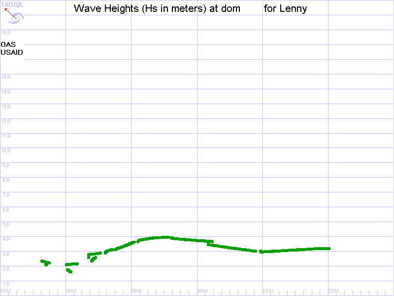
Although predicted surges over the Windward Islands were small, the model indicated that waves of up to four metres were possible over these islands. As a result, Mr. Lovell of the Barbados Meteorological Service was informed as these waves were predicted to affect Dominica and the other islands.
Mr. Jeremy Collymore (CDERA) telephoned during the afternoon of November 17 inquiring whether CIMH had run the model. He was informed of the run and that the relevant information had been passed on the meteorological services. He was briefed on the results of the run.
Below are the peak storm surge map and a few examples of the wave hydrographs.


| USAID/OAS Post-Georges Disaster Mitigation: http://www.oas.org/pgdm | Page last updated on 12 Feb 2001 |