![]()
![]()
![]()
![]()
![]()
![]()
![]()
Geomorphology*
Geologic history
Natural vegetation*
Wildlife*
Brief history of Grenada
![]()
* Researched by Bruce Johnson, United States Peace Corps Volunteer, Land Use and Water Resources Division.
Geomorphology is the study of the characteristics and evolution of landforms. The study may involve whole physiographic regions, or be confined to individual structures within a small area, In essence, the geomorphologist attempts to answer the question, "How did the land come to be this way?"
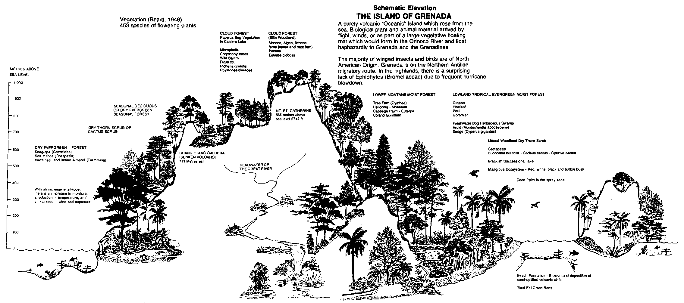
In Grenada the answer to that question involves analysis of several variables: parent material (geology), climate, relief, and time, among others. Grenada has basically two physiographic regions: the rugged, high-relief interior, and the relatively low-relief coastal periphery.
The interior of Grenada is dominated by mountain peaks, steep ridges, and deep narrow valleys. Fast flowing streams with high gradients occur in the valley bottoms. Relief tends to be very high, with a 2000 foot drop over 1 mile horizontal distance in some areas. The volcanic geology of the interior is the dominant factor that produced this landscape. Shifting volcanic vents created a somewhat jumbled topography with several major peaks, each having numerous ridges radiating from them. The Mt. St. Catherine area is an excellent example of this phenomenon. The ridgetops, composed mostly of andesite and basalt lavas, have surprisingly retained their narrow tops and steep sides. This is possibly due to the low permeability of the clay soils to water, the principal erosive agent of the rock.
The coastal periphery of Grenada presents a landscape which is much more subdued than the interior. Again, the major factor appears to be the character of the volcanic center deposits in the area. In contrast to the volcanic centers of the interior, the coastal deposits are dominated by "reworked" volcanic rocks, including fluviatile (stream) and mudslide deposits.
Originally, the topography of the coast may have been quite rugged. But fluviatile and mass-movement processes tend to reduce relief by removing material from elevated areas and depositing that material in the lowlands. Southern Grenada's surface geology is almost entirely comprised of (lahar) mudslide deposits and fluvially-deposited (reworked) volcanics. The rocks exposed in the Southern Seascape Protected Seashore area are of this type. The entire eastern coast of Grenada is composed of reworked volcanic deposits, which accounts for the gently-rolling topography. The western coast displays a more rugged landscape, owing to the asymmetric eruption to the west, which is a pattern throughout the Windward Islands.
Climate is an important factor in the formation of topography. In Grenada, the small variation in temperature between sea level and the higher elevations is not of great geomorphological importance, but the great difference in rainfall is very significant. An analysis of rainfall indicates that annual rainfall varies directly with elevation. Since water is the principle erosive agent on the Island, the high elevations are eroding at a greater rate than the lowlands. Over time, this disparity in erosion will serve to reduce the relief between the interior and the coastal periphery.
An important manifestation of the weathering process is the formation of soils. Soils form from the same interplay of factors which influence topography, with vegetation becoming a significant variable. As indicated by Vernon (1959), climate is the single most important factor in the distribution of Grenadian soils. Therefore, in the Island's interior the soils are indicative of a high degree of chemical weathering, consistent with the high rainfall. The soils are generally kaolinitic latosols, meaning a highly leached soil with kaolinite as its principal clay component. The predominance of iron and aluminum oxides in the soil give it a distinctive bright red to orange-yellow color. The latosols have a poor nutrient-storage capacity, are fragile, easily disrupted and must be carefully managed.
Schematic Elevation - THE ISLAND OF GRENADA
|
|
POINT SALINE |
ANNANDALE FALLS |
FOOTHILLS OF MT. ST. CATHERINE |
LAKE ANTOINE |
LEVERA POND |
SUGARLOAF ISLAND |
CORAL REEFS | |||
|
WILDLIFE - 150 Species of Birds (Groom, 1970) |
House Gecko |
Garman's Woodland Frog |
- Manicou or large opposum |
- Tilapia and other freshwater fish |
- Rich in Aquatic Waterfowl migratory warblers, herons. |
- Turtle nesting 4 species |
- Conch | |||
|
PROTECTED AREA |
Molinere Reef |
Canoe Bay |
Annandale Falls Natural Landmark |
Grand Etang |
Mt. St. Catherine |
Mt. Hope |
Lake Antoine |
Levera National Park |
|
Saline-White |
|
UNIQUE AMENITIES |
Finest Reefs in Grenada |
Scoria and Ash deposits |
Oldest known rocks in Grenada - Folded and faulted sedimentary formation |
Andesite Dome |
Mudflows Hot Springs Highest peak in Grenada |
Important water Quality & supply region for Grenville |
- Explosion Crater |
Andesite |
Rocky cliffs and |
|
|
MANAGEMENT OBJECTIVES |
- Research |
- Recreation |
- Recreation-Tourism |
- Recreation |
|
- Watershed management |
- Recreation |
- Recreation |
| |
Joint Government of Grenada/OAS Project on the Establishment and Management of a System of National Parks and Protected Areas.
Reconstructing Grenada's geologic history poses a formidable task for the geologist. Most of the Island is covered by soil and dense vegetation, and rock exposures are often severely weathered. Topographic relief is great, which makes the stratigraphic correlation of rock units even more difficult. Most significantly, the geology of Grenada is complex and presents many rock types of different ages.
Several geologic studies have been conducted in Grenada, dealing with the chemical composition of particular rock types. The precise relationships between various rock units are not well understood, due to vegetative cover and the fact that volcanic centers shifted many times over millions of years. This shifting often resulted in the juxtaposition of rock units of different age, type, and volcanic source, making geologic interpretation difficult. Erosion which occurred during and between periods of active vulcanism further obscures the geologic record.
To date, the most probable chronology of events is presented in a paper by R.J. Arculus (1976), although even the author admits to gaps in the data. The following description of Grenada's geologic history is drawn primarily from the 1976 Arculus study. Table I summarizes the sequence of events, and Table II lists some geologic features by period and where they are represented within Grenada's National Parks System.
The geologic history of Grenada began approximately 38 million years ago in the upper Eocene Period. At that time, there was only a shallow sea where Grenada now exists. The sediments deposited were composed of sand, silt, mud, and calcareous mud; the rock formed from this process is now known as the Tufton Hall Formation. In between the sediments of the Tufton Hall, geologists found layers containing volcanic minerals and other deposits of volcanic origin. Volcanic activity became more frequent in the Oligocene period (37-26 million years ago). The volcanic activity during and following the deposition of the Tufton Hall formation deformed and uplifted the rock, resulting in the folding and faulting which can be seen just north of Levera Beach.
The oldest of the volcanic rock series are the andesite domes of northern Grenada, which formed in the Miocene Period (26-5 million years ago). These andesite domes (Mt. Alexander, Mt. Rodney, Mt. William) have been estimated by radiometric dating to be 21 million years old. The middle Miocene Period is not well represented in Grenada, but the andesite domes of Levera Hill and Levera (Sugar Loaf) Island represent volcanic activity near the end of Miocene time. Thought to be concurrent with the Levera events were the eruption of the southeast mountain and Mt. Lebanon centers, which recorded the first major shift of eruptive centers to the south.
The Pliocene Period (5-2 million years ago) witnessed the advent of Grenada's most intense volcanism. In the southwest of the island, basaltic lava flows estimated at 3.5 million years old are interlayered with reworked volcanic sediments. The source of the basaltic lava was probably the Mt. Sinai Centre, but the conclusive evidence is buried beneath younger volcanics. Most of the "reworked" deposits in southern Grenada are theorized to be lahar deposits of various ages. A lahar is a massive mudslide of unconsolidated volcanic products from the sides of volcanoes. The massive, in-filling character of lahar deposits is thought to be responsible for the relatively subdued topography of southern Grenada.
In the north of central parts of the Island, major eruptions re-occurred in the Pliocene and continued into the Pleistocene Period. The Island's interior was the scene of intense activity as a series of eruptive centers shifted southward from Mt. Granby towards Mt. Qua Qua, emitting a variety of volcanic products. A source near Mt. Granby emitted pyroclastic products (many of which were later reworked) and a series of basaltic and andesitic lavas. The eruption of basaltic and andesitic lavas continued as the vents shifted southward. The chemical composition of these lavas is geologically important because it displays the cyclical nature of magma composition as eruptions occur over time; there is a repeated transition from basalt to andesite compositions. Some basaltic ash layers near Fedon's Camp indicate that a degree of explosivity characterized the eruptions. The final stages of this activity formed the andesitic dome summits of Fedon's Camp and Mt. Qua Qua, and probably ended with the extrusion of basaltic lava on the western ridges of Mt. Qua Qua.
The Mt. St. Catherine massif represents the youngest major volcanic structure on the Island. Activity at this centre likely began in the Pliocene and continued throughout the Pleistocene. Initially, a vent near the Plaisance/Malagon area extruded basaltic lavas, which were overlain by a series of andesitic and dacitic lava flows. As the vent migrated southward, andesitic and dacitic lavas were deposited to the northwest of the present summit. The Pyroclastic flows to the west of the present summit are the most voluminous deposits of their type on Grenada. The large (1½ Km diameter) crater to the South-east of Mt. St. Catherine was partially filled-in by an andesitic dome which probably concluded the eruptions in the area.
The final stage of volcanic activity involved the formation of explosion craters throughout the Island, most notably at the Lake Antoine, St. George's, and Grand Etang locations. Lake Antoine is a well-preserved crater, and has been described as the best example of a true "tufaceous ring" on the Island. The carenage of St. George's and the Queen's Park are both believed to be explosion craters, giving the Island its best harbour and best source of scoria gravel. The three closely-spaced explosion craters at Grand Etang are generally thought to be the youngest volcanic structures on the Island, having formed approximately 12,000 years ago.
In recent times, volcanic activity on the Island of Grenada has been virtually non-existent, with the minor exception of some hot springs. Most of these hot springs occur in the Mt. St. Catherine area and emit sulphurous water and vapor. Other springs such as the River Sallee and Peggy's Whim Springs are not sulphurous to any extent.
Just 8 kilometers to the north of Grenada, however, is one of the most active volcanoes in the Lesser Antilles. It is a submarine volcano, 160 meters below sea level, known as "Kick 'em Jenny" for the nearby Island of the same name. It has erupted at least half a dozen times this century, with the last eruption occurring in 1978. It is possible that the volcano may emerge during its next eruption. Scientists in Trinidad are currently monitoring this area for seismic disturbances, which might indicate renewed activity.
*As adapted from (Beard, 1949)
According to Beard (1949), the existing vegetation in Grenada is a result of land-use history and differences in soil types and rainfall regimes. Grenada is intermediate in age between young St. Vincent and old St. Lucia. The principal peak. Mount St. Catherine (2,757 feet), rises in the northern half of the Island as the centre of a massif surrounded by lesser peaks and ridges. South of this massif is a low col where the Clozier road crosses the Island, and beyond it the land rises again into a long, curving ridge, or system of curving ridges, running first towards the south and then bending to
TABLE I - SCHEMATIC GEOLOGICAL HISTORY OF GRENADA
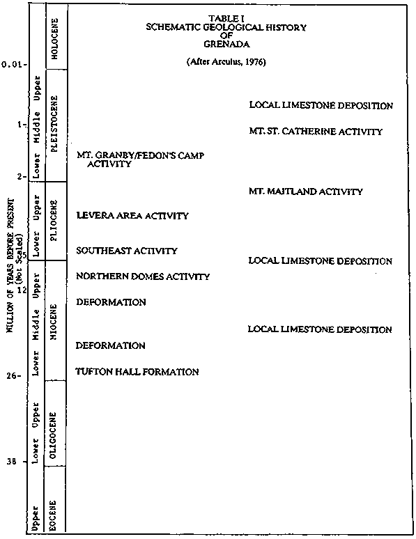
(After Arculus, 1976)
Except in the higher parts of the mountains, slopes are not excessively steep. As a result, with the small size of the Island's land mass, large areas have been cleared for agriculture including fruit, cocoa and nutmeg.
In the interior, practically all the land was originally sold out to estates, and cultivation was pushed to the highest practicable limit in most cases, though some owners reserved belts of forest on ridges for protective purposes. The Government began the consolidation of a forest reserve in 1897 and today the Grand Etang Reserve now contains over 3,800 acres. Most of this area has been protected from cutting for over eighty-five years, although Hurricane Janet of September 22, 1955 caused extensive blow-down damage. These areas were subsequently planted to Blue Mahoe, a tree noted for its value in watershed protection.
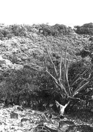
Slopes on Mount St. Catherine are extremely steep and the central massif is clad only with palm brake. Elfin woodland caps the summit and there is secondary, cut-over rain forest on the lower supporting ridges. A similar condition prevails on the steep mountains of Fedon's Camp and Qua Qua. Owing to the steep slopes and young shallow soil, landslides are very frequent. South of Qua Qua the forest growth is more diverse and includes the last remnant lower montane forests in Grenada. In the sheltered lower elevations, the forest is mature, and comparable to the type of rain forest exemplified in the other Islands. Ascending towards the main ridge forest, stature is progressively reduced, and along the crest, montane thicket predominates.
Overall, Grenada has less vegetative diversity than other Islands in the Lesser Antilles.
The main reason for this is not geographical isolation but rather that the flora was profoundly modified by felling of the valuable timber species during the nineteenth century. Most of the original species are now extinct and have been replaced by second-growth forests which grew into a mature structure by the protection afforded since the establishment of the forest reserve. Physiognomically, the forest can now be said to belong to the rain forest formation, lower montane rain forest, and montane thicket, since structure has reached climax. Floristically the communities are associes and not associations, since they are still below climax rank.
1. Rain Forest and Lower Montane Rain Forest
Beard considers these two formations together since there is very little difference in floristic composition between very tall forest with the structure of rain forest proper, and less tall forest approximating lower montane rain forest in Grenada. There is a very gradual reduction of stature and stratification with increasing exposure, and elevation and only on the ridge tops with growth reduced montane thicket is there any radical change in composition. We have therefore a Dacryodes-Licania associes belonging to the montane thicket. The latter is evidently sub-climax to the general Micropholis-Richeria-Podocarpus Association of the Islands, and the former, presumably, to both the Dacryodes-Sloanea and Licania-Oxythece Associations.
Beard illustrated a profile in the Grand Etang Reserve, at the 1400 feet level across the slope at a point where the line ran practically level. The strip is roughly at right angles to the prevailing wind. Dominant trees reach 100-110 feet in height and form a closed canopy. All of them on the strip were Dacryodes excelsa except for one individual Maytenus grenadenses. Most of the smaller trees, which fell roughly into two stories, between 40-80 and 15-30 ft, were Licania ternatensis. The structure agrees very well with that shown by measured profiles in rain forest of Dominica and St. Kitts. The Grenada sample is somewhat denser and shows no sign of wind damage.
The Dominants are (Beard, 1949):
|
Dacryodes excelsa |
(Gommier) |
|
Slonea caribaea |
(Chataignier grandes feuilles) |
|
Micropholis chrysophylloides |
(Bois) |
|
Simarouba amara |
(Marouba) |
|
Oxythece pallida |
(Balata laite) |
|
Ficus spp. |
(Figuier) |
|
Slonea truncara |
(Chataignier petites feuilles) |
Species almost never attaining the canopy and ranking as sub-dominants were:
|
Licania ternatensis |
(Bois gris) |
|
Euterpe sp. |
(Mountain Cabbage Palm) |
|
Guatteria caribaea |
(Mahot) |
|
Maytenus grenadensis |
(Bois agouti) |
|
Richeria grandis |
(Bois bande) |
|
Byrsonima martinicensis |
(Mauricif) |
|
Hex sideroxyloides |
(Caca rat) |
Species confined to the lowest story were:
|
Cassipourea elliptica |
(Bois d'ail) |
|
Myrtaceae spp. |
(Goyavier) |
|
Meliosma herbertii |
(Grosse gram) |
|
Guarea macrophylla |
(Bois rouge) |
|
Ocotea floribunda |
(Laurier petites feuilles) |
|
Euterpe globosa |
(Mountain Palm) |
|
Sapotaceae sp. |
(Sapotere) |
|
Pithecellobium jupunba |
|
Beard indicates that the forests of Grenada differ from those of the other Islands in two main respects - paucity of species and altered relative numbers of the species present. Grenada is at an extremity of the arc of the windwards and is 70 miles from St. Vincent; the Grenadines in between may never have stood high enough to harbour a rain forest flora and so are not associated with assisting the migration of these species.
From the point of view of relative numbers of species in composition, the most surprising thing is the complete absence of stocking resembling the Licania-Oxythece Association, although the forest is on Red Earth Lateritic oxisols and in its 'low phase' agrees structurally with lower montane rain forest. Both Licania and Oxythece are present in Grenada, but are never the principal dominants. Beard suggests the probability that we must blame man's exploitation of timber in the past for such floristic differences that exist. Manilkara bidentata, which is one of the most valuable of all the timbers, is not found in the reserve at all. Hicronyma caribaea and Ormosia monosperma are found only in secondary growth. Meliosma herbertii, Simarouba amara, Ocotea floribunda, Oxythece pallida, Pouteria multiflora, and Phoebe clongata are rare to very rare and are present usually as young specimens only. All these are the valuable timber species which were presumably cut out during the nineteenth century. Local information indicates that this was the case.
2. Montane Thicket
Montane thicket in Grenada covers the summit of the main watershed from Mount Qua Qua south towards Mount Sinai and lesser ridge tops in the area. Micropholis chrysophylloides is dominant and forms 40 percent of the crop. Nearly all the big trees are of this species, some of them up to 6 feet in girth. Associated species are principally 'goyavier' (group of Myrtaceae sp.,) 19 per cent., Licania ternatensis 11 per cent., Euterpe globosa 9 per cent., Dacryodes excelsa 5 per cent., and Richeria grandis 4 per cent. Less commonly Euterpe, sp., Rapanea guianensis, Oxythece pallida, and Ilex sideroxyloides are found. Composition has probably been affected by fellings in the past as is the case of the rain forest. There is virtually no shrub layer at all. Epiphytes seem to be confined to small orchids and ferns and while there are few climbers, the forest is extremely mossy. Ground vegetation is knee-high and thick beneath typical montane thicket, consisting of seedlings, ferns, and razor grass Scleria. In the profile lee of the ridge, the ground vegetation increases to waist high and is a tangled mass of razor grass, ferns, Ischnosiphon arouma, seedlings and young palms.
3. Elfin Woodland and Palm Brake
Beard (1949) considered Elfin Woodland and Palm Brake together. They exist for the most part in rather intimate relationship. The steep slopes of St. Catherine and the windward sides of Qua Qua and Fedon's Camp are covered with a patchy growth seamed with the traces of landslides, running up and down the slope. One may see the bare earth of fresh slides, or recent ones covered with moss which appears to stabilize the soil, the next stage being a thicket of small tree ferns Cyathea or balisier Heliconia bihai. Other landslides may be colonized by Euterpe globosa, forming a patch of palm brake. All these successional stages are set in a matrix of Elfin Woodland, a repressed growth 10 feet in height, gnarled, mossy, and containing the typical elfin species: Charianthus purpureus var., Weigeltia antillana, Didymopanax attenuatum, Ilex sideroxyloides, Rondeletia stereocarpa, Rapanca ferruginea and R. guianensis, Myrcia berberis, Byrsonima martinicensis, Stylogyne lateriflora, Besleria lutea, and a few Euterpe globosa. The palms are stunted and the tips of the leaves appear scorched.
Most vegetation is covered with moss, epiphytes and climbers. At the summits' of the mountains pure stands of Elfin Woodland are found. On the very top of St. Catherine and Fedon's Camp growth is reduced to waist height.
On many of the leeward slopes of the southern mountains Fedon's camp, Qua Qua, South-east Mountain, Montane Thicket is replaced by clumps or groves of Euterpe, sometimes 60-70 feet high and far overtopping the stunted forest. This is evidently a sub-climax type, due to storm damage.
4. Secondary Tropical Rain Forest
There is a good deal of secondary growth on land formerly cut over by shifting cultivators along the Mount Sinai ridge and in the Mount Sinai water catchment. Such growth varies from a dense crop of herbaceous Heliconia bihai to young forest, according to the stage of succession. The subsequent tree pioneers are, most conspicuously, Nectandra antillana and Guarea macrophylla, the latter here appearing in an unusual role. Other species include Sapium caribaeum, Hicronyma caribaea, Euterpe globosa, Cecropia peltata, Cordia sulcata, Ocotea martinicensis, Ochroma pyramidale, Inga edulis, and Miconia guianensis. In the lower part of the Mount Sinai catchment conspicuous pioneer species include Byrsonima spicata and Manilkara bidentata.
5. Dry scrub Woodlands
Beard (1949) states that the only example of fairly intact woodland of the Tropical moist forest belt seems to be that crowning Morne Delice, an isolated, high and conical hill 900 feet in height, 2 miles inland from the south coast. Tree growth has evidently been allowed to remain due to unsuitability of the terrain for cultivation, but has been subject to frequent fellings. At the bottom of the hill there are young secondary thickets of mahogany Swietenia mahagoni, white cedar Tabebuia pallida, Guettarda scabra, and other pioneers.
Most other examples of tropical moist forest consist principally of young Swietenia mahagoni, an invasive species, or of low bush with Acrocomis palms. Nearer to the coast in the dry belt only very impoverished growth remains. At best there are woodlands 30-40 feet high on rocky hill-tops, containing mostly the naked indian Bursera simaruba, with a few individuals of Lonchocarpus latifolius, L. benthamianus, Albizzia caribaea, Citharexylum spinosum, Pisonia fragrans, Tabebuia pallida, Chlorophora tinctonia, Genipa americana, and Cordia collococca. Undershrubs include Bauhinia ungula, Pithecellobium unguis-cati, Tecoma stans, Amyris elemifera, Randis mitis, Jacquinia barbasco, and Annona squamosa. When severly degraded by cutting on eroded slopes, the tropical moist forest may be replaced by thorn bush of Haematoxylum campechianum. Poor grazing land is also colonized by open thorn bush with Acacia nilotica, A. farnesiana, Haematoxylum, and various native shrubs including prickly pears Opuntia dillenii and columnar cacti Cephalocereus. Most of the Point Saline peninsula is covered by alternations and mixtures of these same types (Beard 1949).
6. Littoral Woodland
Very little remains of this formation in Grenada. At Levera in the north-east the littoral hedge is formed of Conocarpus erectus, Jacquinia barbasco, and white cedar Tabebuia pallida (in its monophyllous form). The woodland behind contains also sea grape Coccolobis uvifera, mapou Pisonia fragrans, manchineel Hippomane mancinella, Erithalis fruticosa, Bourreria succulenta, Pithecelloboi unguis-cati, and Rheedia lateriflora. On the Point Saline peninsula some sandy raised beaches carry pure groves of Hippomane mancinella up to 50 feet in height.
7. Swamp
There are some small mangrove swamps, chiefly at Levera Pond in the north-east and at the head of the various deep inlets of the south coast. These contain the usual red mangrove Rhizophora, black mangrove Avicennia, white mangrove Laguncularia, and button mangrove Conocarpus. In all cases they are recommended for protection.
* As adopted from "A Natural History of Grenada," J.R. Groom 1968.
Grenada is the last remaining portion of the Grenada Bank - a volcanic entity, with sheer submarine cliffs stretching from the Island of Bequia in the North to Reindeer Shoal in the south. Deep water separates Grenada from all other major Islands (St. Vincent, Barbados, Trinidad and Tobago), which gives added evidence that Grenada is a purely volcanic Island which rose from the sea never having had a land bridge between any other land mass other than the Grenadines. Grenada and the Grenadine Islands may have been an "Oceanic Island" since during the Pleistocene period (Glacial Epoch of one million years ago) when the sea level is estimated to have been between 50 and 150 fathoms lower, plants and animals may have been able to spread throughout the Grenada Bank.
The Oceanic Islands such as Grenada (Volcanic) or Barbados (uplifted coral) will present a relatively poor biological diversity compared to Trinidad and Tobago, which were at one time connected to the biologically rich South American Continent. In Grenada, animal and plant migration would have only occurred by flight, winds, or as part of a large vegetative mat which would form in the Orinoco River, and float haphazardly to Grenada. Interestingly, the majority of winged insects and birds are of North American origin indicating the Island is on the Northern Antillean migratory route.
INVERTEBRATES: Groom, 1970, indicates that no endemic invertebrates have been described in Grenada with the possible exception of the weevil Diaprepes. The centipede whose bite causes a swelling, is the only dangerous animal per se in Grenada. Neither the parasol ant Acromyrmex octospinosus, or the water snail Australorbsis glabatrus, the secondary host of S. mansoni which causes Shistosomiasis and which is prevalent in the freshwater streams and ponds of St. Lucia, occur in Grenada.
VERTEBRATES: Island isolation has given Grenada a much less spectacular flora and fauna than Trinidad and Tobago, for example, because of the difficulty the animals have in arriving to Grenada. Furthermore, almost all of the forests of Grenada below 2,000 feet have been altered for cocoa, nutmeg, or banana production. Some examples of South American fauna such as ground lizards Ameiva and skinks Mabuya are found in Grenada. Groom, indicates that Grenada appears to have no Greater Antillean types of indigenous amphibians or reptiles, but only South American stocks which arrive here on floating mats of vegetation. Myers, 1937 again supported the Oceanic Island theory by stating, "The most striking feature of the fresh water fish fauna of the West Indies is the complete absence of members of the primary division of fresh water fishes, in particular the Ostariophysi, which swarm in all the waters of North, Central and South America".
AMPHIBIANS: In general. Groom, 1964 states "Amphibians are absent on Oceanic Islands, for their eggs and tadpoles require fresh water and their skins are totally allergic to salt."
Present are: The giant toad Bufo marinus, the piping frog Eleutherodactylus and the highland piping frog E. johnstonei which is confined to the remnant forests of the Grand Etang.
Garman's woodland frog Leptodactylus wagneri is found which is also characteristic of the primeval forest of the Grand Etang Forests.
The giant woodland frog Leptodactylus fallax an edible frog, was introduced but apparently did not survive.
REPTILES: There is one island endemic, Typhlops tasymicris, which is known only from St. David Parish, Grenada (Schwartz and Thomas 1975); no information is available on its ecology or status.
The house gecko - Thecadactylus rapicauda is an object of superstition.
The spinous gecko Hemidactylus mabouya was introduced from Africa.
The common anole or wall lizard Anolis aeneus, is found from Trinidad to St. Vincent. The crested or tree lizard (Anolis richardi) is found only from Tobago to Grenada and some Grenadines.
Iguana iguana is becoming increasingly more rare due to hunting and its reputation as a culinary delicacy.
Garman's ground lizard - Ameiva ameiva or zaggada, a handsome blue colored lizard, (male) is now found only in Grenada and the Grenadines. It is a sun loving lizard and was almost brought to extinction by the mongoose.
Alien's Ground Lizard - Bachia heteropus alleni, is found throughout the Grenadines. The South Antillean slippery back lizard -Mabuya mabouya was thought to have been extinct, but it appears that its numbers are increasing.
OPHIDIA SNAKES
The following snakes, none of which are venomous, are found in Grenada.
The white headed worm snake Leptotyphlops margaritae.
The tree boa Corallus enydris cookii.
Boddaerts's tree snake Mastigodryas bruesi Cribo Clelia clelia a powerful constrictor, feared locally for it's strength, is also an excellent rodent exterminator.
Moon Snake Pseudoboa neuwidii.
CHELONIIDAE - Turtles
Sea turtles nest on the beaches on the Windward side of Grenada and Carriacou. The females crawl up the beaches and lay their eggs in the dry sand of the spray zone.
Green turtle -Chelonia mydas - are heavily chopped as they come to the beaches to lay up to 600 eggs in a season.
Hawksbill turtle - Eretmochelys imbricata is carnivorous, and like the loggerhead feeds on shellfish and rock encrusting marine animals.
Loggerhead turtle - Caretta caretta.
Ridley turtle - Lepidochelys olivacea.
DERMOCHELYIDAE
Leatherback turtle - Dermochelys coriacea is the largest of the sea turtles, weighing up to 500 kilograms.
Testudinidae Tortoise - The morocoy or red legged tortoise - Geochelone carbonaria is thought to have been indigenous to Grenada and the Grenadines but was hunted to extinction. It has since been re-introduced.
In exercise of the powers conferred by Section 40 (r) of the Grenada Fisheries Act No. 15 of 1986, the Minister declared on the 6th May, 1987 the following closed seasons for the harvesting of Turtles, Lobsters and Oysters.
Turtles: 1st May to 30th September
Lobsters: 1st May to 30th September
Oysters: 1st May to 30th September
BIRDS
Birds - 150 species of birds have been identified in Grenada and the Grenadines. (See Groom, 1970).
The avifauna is primarily tropical North American. The avifauna, as compared to Trinidad, is remarkably different considering the islands are only 100 miles apart. The absence of a parrot (amazonas) in Grenada is interesting, considering Islands to the north such as St. Vincent, St. Lucia and Dominica all have their own endemic parrot.
Parrots were recorded in the 1600's by Dr. Tertre (1667-1671) and Labat (1693-1705) in FR. Devas book "The History". Groom, postulates that these may have been driven to extinction by the aggressive introduced African mona monkey. These monkeys would be largely responsible for predation of the eggs in the parrots nests.
Ornithologists attribute the peculiar distribution of birds to the hurricane frequency. Since some species are noted for the first time after a hurricane and others may never be seen again.
In the "Protection of Birds and the other Wild Life Ordinance, 1956" Chapter 56 of the revised laws of Grenada, p.347, all wild birds and their eggs are given absolute protection throughout the year, with the exception of 19 species for which there is an open season from September to February. Ducks, waders, waterfowls, pigeon and doves may be hunted, and Buteo and Falco peregrinus may be legally shot in defence if they attack chickens.
Three species of birds are listed as endangered species by the IUCN Red Data Book. These are:- Chondrohierax uncinatus murus, Grenada hookbilled kite; Leptitilia wellsi, Grenada Dove; and Empidonax euleri johnstone, Euler's fly catcher.
There is one endemic species, the Grenada dove Leptotila wellsi, which is currently treated by ICBP (1987) as conspecific with the grey-fronted dove L. rufaxilla. There is an account of the species in King (1978-1979), who classes it as indeterminate. The Grenada dove is thought to be very rare and its range is limited to xerophytic scrublands in the southwestern coast of Grenada.
There are no estimates available of population size. The reasons for the rarity of this species are unclear: it is possible that the population has been low throughout this century, or that it has been reduced by competition with one or more of the other species of dove that occur in the same habitat (King 1978-1979).
The following species are endemic to the Lesser Antilles (distributions from ICBP (1987): Grenada flycatcher Myiarchus nugator (Grenada, Grenadines and St. Vincent); scaly-breasted thrasher Margarops fuscus (Saba, St. Eustatius and Barbuda south to Grenada and Barbados; possibly extinct on Grenada and Barbuda); Lesser Antillean bullfinch Loxigilla noctis (Virgin Islands, and Lesser Antilles from Anguilla and Saba south to Grenada and Barbados); Lesser Antillean tanager Tangara cucullata (St. Vincent and Grenada).
Information on seabirds is poor. Halewyn and Norton (1974) list the following three species as possible breeders: Audubon's shearwater Puffinus 1. lherminieri, laughing gull Lams atricilla, and roseate tern Sterna dougallii.
REGION WIDE ENDANGERED SPECIES FOUND IN GRENADA
- Chelonia mydas, green turtle (1,2)
- Eretmochelys imbricata, hawksbill turtle (1,2)
- Dennochelys coriacea, leatherback turtle (1,2)
- Falco peregrinus tundrius, tundra peregrine falcon (2)
- Pallinueus sp, spiney lobster.
- Strombus gigas, queen conch.
SOURCES
1. Lazell, 1980
2. IUCN Red Book
MAMMALIA - MARSUPIALIA
Marmosa robinsoni - Chapman's murine opossum, mouse opossum or manicou is strictly a nocturnal animal which uses its prehensile tail for climbing and transporting bedding material.
Didelphis marsupialis insularis - large opossum or manicou is a common omnivorous animal which may prey upon poultry and is hunted for its meat. This species may have been introduced by Amerindians while making journeys in their perogues (Groom, 1970).
EDENTATA
Dasypus novemcinctus hoplites. Nine banded armadillo or tatou. This species is confined to forested areas, and is under heavy pressure from hunting.
CHIROPTERA - Bats
There are eleven different species of bats, with feeding habits ranging from insects and fish to nectar and fruits. The vampire bat is absent.
RODENTIA
Dasyprocta liporina - agouti - This agouti is extinct on the Island due to overhunting and the aggressive mongoose. Hurricane "Janet" in 1955 may have given the final push to extinction. Naturalists of Grenada would like to see the agouti reintroduced (Beresford Wilcox, Pers. Comm.)
CARNIVORA
Herpestes auropunctatus - The burmese mongoose was introduced from Jamaica about 1870 to control rats in the cane belt. Now it is primarily destructive to poultry, wild ground nesting birds, and lizards. The mongoose is the only proven vector of paralytic rabies in Grenada. (Groom, 1970)
PRIMATES
Cercopithecus mona - The African mona monkey was introduced from West Africa during the slave trade period. It may be seen quite readily in Grand Etang and St. Catherine Upper Montane Forests.
They are very dangerous and destructive to the local fauna. The hurricane of 1955 reduced their numbers, but their populations have reached new proportions with the limited use of firearms for hunting during recent years.
ENDEMICISM
"Grenada is such a geologically recent volcanic Island, that it is remarkable it should have some five biological items peculiar to itself: A Dove Leptotilla wellsi regularly recorded, but rare, a sub species of snake, a weevil, the mountain cabbage palm Oreodoxa oleracea and perhaps one of the Grand Etang Ferns Danaea spp." (Groom 1970)
On March 26, 1928 Ordinance Cap: 245 -1934 Revision No. 29 of 1956 stated, "This Ordinance establishes the Grand Etang Forest Reserve as a Sanctuary for the Wild Animals and Birds of the Colony, and to make special temporary provision for the protection of the agouti, armadillo, and certain snakes." The short title of the Ordinance may be cited as the "Wild Animals and Birds (Sanctuary) Ordinance." It essentially establishes the Grand Etang Forest Reserve as a sanctuary for wild animals and birds.
The Schedule (section 5 (2)) protects the following snakes:
Leptotyphlops margaritae - white headed worm snake
Corallus enydris - serpent - brown tree boa.
Mastigodryas bruesi - Booddaert's tree snake
Liophis melanotus - Shaw's racer
Clelia clelia - black cribo
Pseudoboa neuwiedi - Neuweid's moon snake
This act seems to have expired at the end of 1962, as a result, no protection will exist for wildlife until Cabinet approves the National Parks and Protected Areas Program.
The protected areas program includes cultural landmarks, entities which are sometimes managed by the Tourist Board, National Trust or Historical Society in other countries. Significant input will be received from these groups, but it was recommended that the National Parks Division manage these resources. The following brief history mentions how the artifacts and other cultural features portray the fascinating history of Grenada.
The migration of South American Indians from their homeland brought the first inhabitants to the Islands. There were two sets of Amerindians who reached the Island - the Arawaks and Caribs. The Caribs are believed to be fierce and warlike, while the Arawaks were peaceful and loving and highly artistic. It has been written that the Arawaks were harassed by the Caribs which hastened their disappearance. It is also believed that the Caribs made concubines of the Arawak women and killed the men. These people were primarily hunters and gatherers and therefore did not affect the natural vegetation. For over 100 years after the sighting of the Island by Christopher Columbus on his third voyage, the Carib Indians were left undisturbed. In 1609 a company of London merchants attempted to establish a settlement but were compelled to withdraw as a result of the hostility of the native Indians.
Interest in the Island developed by both the English and French in the early 17th century. However, it was not until 1638, that a frenchman named Du Poincy attempted to land. This again was unsuccessful and the natives managed to secure the island from further attempts at settlement for twelve years.
The French successfully settled the Island in 1650 despite the usual native hostility. While it was discovered that the Indians called the Island Camahogne, the English named it Conception.
One year later, the Caribs realized the danger they had exposed themselves to and revolted. By then the French had already established their settlement and called for reinforcement from the French Colony of Martinique. The Caribs retreated to a precipitous hill in the north of the Island where they sought refuge. After a great search, the French discovered their refuge and took them by surprise. Most of the Carib Indians leaped into the sea below committing suicide.
Few elements of Amerindian culture survive today. These include words of Amerindian origin, some pottery and other remains found at the museum and petroglyphs in the Mt. Rich area. The Leapers Hill and town of Sauteurs got its name from the tragic event that brought the Indian occupation to an end.
The early French settlers established plantations of indigo, cotton and tobacco. At the beginning of the eighteenth Century, indigo seems to have been the main crop. It is recorded that in 1700 there were fifty-two indigo plantations on the Island. In 1702 sugar cane was introduced from South America and cane cultivation gradually took over from indigo in the early 18th century. Sugar cane cultivation necessitated the introduction of cheap labour into the country and therefore, the slave trade was developed. Africans, East Indian indentures, Portuguese, Chinese and other European bondsmen were introduced to work the plantations for the French. Until the abolition of slavery in 1834, sugar cane was by far the most important crop cultivated on almost all low lying land in the country. Cocoa was introduced to the island in 1714.
In 1763 the British secured the Island by the Treaty of Versailles of Paris. Grenada was surrendered to the British at Fort Royal (Fort George). It is important to note that every military handover in Grenada's history was done at this Fort, and every time the island changed hands, its name was changed also. Even the March 13th, 1979 Revolution saw a change of name from Fort George to Fort Rupert. This was subsequently changed back to Fort George after the intervention of American forces in October 1983.
The French temporarily regained Grenada in 1779 during the American war of independence. Four years later, the Island was handed back to the British by the eighth Article of the Treaty of Versailles.
There was always discord among the British and French Colonists on the Island. This caused a major uprising by the French planters against the British Colonist in 1795. In 1789, the French Revolution broke out under the watchwords of Liberty, Equality and Fraternity. Victor Hughes was the agent of the Revolution in the Caribbean with Headquarters in Guadaloupe.
Julien Fedon, a mulatto of French origin who owned the Belvedere estate, which was then the largest estate in Grenada, was in total support of Victor Hughes. In 1795 confusion broke out between the French planters and British colonist. On the night of March 2nd the French took to "looting, fighting and even seizing British citizens". Fedon joined by slaves and "Free Coloured" took possession of all the Island except St. George's. The rebels killed forty eight (48) of the fifty two (52) British citizens on the Island. In 1796 the British managed to reinforce their contingents with officers from Trinidad. They eventually captured the final strong hold of the French, which was the Fedon's Camp located at one of the flat topped peaks in the central mountain range.
Fedon on way to camp

After emancipation the labourers were no longer willing to work as regularly on the estates and a severe economic depression followed. The planters also had to compete on the European market with the sugar still produced in the Spanish colonies by slave labour. An attempt was made to introduce indentured labour but that also was unsuccessful. Much of Grenada was deforested for conversion to sugar, and thereafter extensive deforestation continued in order to fuel the rum distilleries. Gradually, sugar production was replaced by cocoa which demanded less labour per acre than sugar. Cocoa at that time drew a good price on the European market. The emancipated slaves and indentured labourers took readily to these crops; a quantity of land could be easily had in the interior and the cultivation of cocoa offered an independent existence and reasonable profits for a minimum of labour. This lead to the clearing of a large part of the remaining upland natural rainforest.
Nutmeg was first introduced into Grenada in 1843, however, it took considerable time for the crop to become a significant export.
After many years of trial the crop became well established.
From the beginning of this Century, tree crops have been the predominant form of agriculture and are of considerable importance to the Island's economy. It was only after the 1955 hurricane that banana became an important crop.
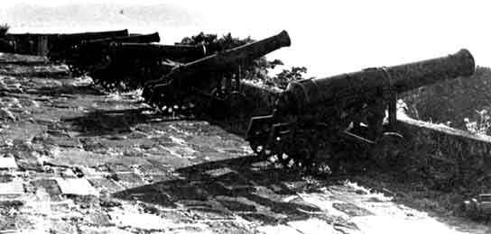
Fort George built in 1706 by the French.
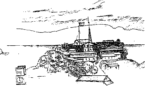
Fort George was built in 1706 by the French. More recently the Fort again became important in the history of Grenada when Maurice Bishop and part of his cabinet were assassinated by a split faction in the People's Revolutionary Government.

![]()
Geologic history
Climate
Land-use history
Natural vegetation
Brief history of Carriacou*
![]()
The Grenadine Islands and Carriacou represent the exposed summits of peaks on a single narrow bank of submerged volcanic mountains. The Island of Grenada is separated from Carriacou by a channel 600 feet deep.
The Grenadine Islands came into existence in the late Oligocene period, sank or eroded away during the Pliocene and were completely submerged during the Pleistocene period. Since that time, a regional uplifting of the sea floor has raised the Islands above sea level (Howard, 1950).
The diversity of the geological formation of the Grenadines is fascinating. Bequia is characterized by pyroclastic rocks preponderant over massive. Some islands have red and white clays due to laterization and kaolinization of the volcanic andesites in situ. Other islands are weathered rugged volcanic rocks and agglomerates.
Carriacou, an Island of 34 square kilometers has been studied by geologists since the 19th century. The most recent studies have indicated fossiliferous limestone formation ranging in age from upper Eocene to Pleistocene.
The Island can be divided into two zones:
(i) The Fossiliferous limestone area which is mainly of the miocene age with outcroppings in the eastern part. This non-volcanic formation is characterized by continuous stratifications of calcareous, clastic and volcanic lithofacies; and(ii) The volcanic area which covers about two thirds of the Island. This section consists of lava flows, lava domes and volcanoclastic products ranging in age from Miocene to the Pliocene (Briden et al., 1979).
The climate of the Grenadines is a relatively uniform one characterized by a northeast breeze which prevails most of the year. The temperature averages about 80 degrees F. in the dry season and 74 degrees F. in the rainy season. Significantly less rain falls on the smaller Islands; from 50 - 70 inches per year. These drier conditions predominate because of their inability to cause condensation due to a lack of a high cordilliera. On Union Island for example, a high rainfall count of 62.24 inches was tabulated, and a low of 25.7 inches with a 13 year average of 37.67 inches.
The Islands had a deep fertile soil at the time they were settled, which was utilized first primarily for cotton, a short time for sugar cane and thereafter for cotton. Sugar cane was phased out with the abolition of slavery and with the decline of the world price of sugar.
Cotton is no longer an agricultural product, production having tapered over the last 40 years. As with any monoculture agriculture, insect infestation developed. The necessity of controlling the insect pests without insecticides led the farmers to rip out the annual crop and burn it thereby killing the insects and eliminating their food source. Even wild cotton was removed. The result was devastating as further soil erosion occurred at an accelerated rate.
Limes were also grown on Carriacou up until the turn of the century, but production per acre was less than the yields realized in Grenada. Lime production was profitable until 1920 when many of the groves were abandoned.
Coconuts were planted in the 1870's but were depleted in the late 1870's. Livestock were subsequently introduced on the smaller islands once soil fertility was depleted. Finally goats and black-bellied sheep were introduced and still provide improved breeding stock for Grenada. Sheep, cattle and goats are causing significant soil erosion resulting in decertification on the island. Compounding this problem is the "Let go season" where the animals are released to fend for themselves during the dry season. They promote rill and gully erosion which down cuts the subsoil and as a result water storage capability is reduced. Animals also reduce reforestation efforts and potential crop production. Although animals are very important to the economy, fencing and pasture establishment is needed. Some coconut plantations still exist which are in need of management and protection.
Beard's 1949 work, The Natural Vegetation of the Windward and Leeward Islands discusses "seasonal formations". When the evaporation from freshwater ponds and streams and the transpiration from plants exceeds the rainfall, a drought begins to occur. This is estimated to be at around 4 inches of rainfall per month (Charter, 1941). If the period of drought is short, the vegetation will be little affected, but longer droughts, as are characteristic during the dry season December through June, will adversely affect the diversity of flora. As a result, the smaller Islands are represented by a Dry Thorn Scrub - Cactus - Legume Association at its best developed stage. The plants have leaves during the rainy season, and with the exception of a few species, are leafless during the dry season, hence the plant association Dry Deciduous Seasonal Forest.
Areas deforested and left to "old field succession" generally come back in pure stands depending on adjacent seed source, relief, and soils. Vegetative tufts of Croton, Cordia, or Leucaena can be found, as can Bauhinia ungula and Cuidosolus ureus (Howard, 1950) (Beard, 1949). These forest type sub-climaxes are found primarily on the leeward side of the Islands.
On the windward side of the Islands, Coccoloba uvifera, Hippomane manchinella and Cocos nucifera are found on the beaches on the moist lowlands which descend to sea level. On the slopes which begin from the wave cut cliffs, the contorted, wind sheared and salt sprayed growth of Randia aculeata, Tabebuia pallida, Coccoloba caribaea, and various species of Capparis predominate. Opuntia dilleiri and Agave caribaeicola are found on the most extreme rocky steep cliffs. More inland the typical spiny Acacia - Albizzia - Pithecellobium Association may be identified.
Dominants in the open woodland are Bursera simaruba, Brosimum alicastrum, Pisonia fragrans, Ficus lentiginosa, in order of frequency.
Three epiphytic air plants are noted. These are Aechmea lingulata, Tillandsia utriculata and Tillandsia flexuosa. The latter two are in the pineapple family.
Two rare and unusual plants found on Carriacou are Morisonia americana or jumbie sapodilla and Lemna perpusilla which has been found growing on the surface of ponds.
* The following section is adapted from Howard, (1950)
Carriacou is the largest of the Grenadines in Grenada territory. It is seven miles long and three miles wide at the broadest point. The island is irregular in shape with a ridge running the length of it averaging 750 feet in height with the highest point, a hill at the northern end called High North, reaching 850 feet above sea level.
Carriacou with a population of 5,000 or more is the seat of Government for the Grenada Grenadines. The largest town on the island is Hillsborough.
Carriacou is composed mainly of subsistence agriculturalists who cultivate vegetables including sweet potatoes, pigeon peas, and corn. Tomatoes and lettuce are grown in very small quantities. Small amounts of peanuts are grown for export.
In the past century Carriacou produced limes as the principal crop. Today, sugar is no longer grown and the lime industry is intermittent. Throughout the island one finds ruins of old houses and windmill towers which were used in grinding cane. Some of these features will be protected as cultural landmarks.
Water is a chronic problem on Carriacou. According to the historic documents the land was once forested and sugar was grown at the lower levels. Irrigation channels were established in the late 1700's and used to direct rainwater from the hills for agriculture. In 1891, according to Dr. Nichols' diary, water was in such short supply that it was necessary to import water for human consumption from Grenada. In 1891 a few wells were sunk to obtain ground water. One on the grounds of the old Limlair Estate is a recommended cultural landmark. Today, most houses have their own water collection and storage system. Lack of water remains one of the chief problems limiting development on the island.
The middle of the island is a designated forest reserve under the supervision of the Forestry Department. A representative of the Forestry Department patrols the area to prevent the inhabitants of Carriacou from cutting wood and quarrying in the area.
The agriculture of a century ago covered practically all of the lands on Carriacou. Nichols reports cotton fields extending from the town of Hillsborough to the top of the ridge and continuous to the eastern coast and extending from one end of the island to the other. As a result, the intensive agricultural practices of over 200 years have left the island mostly deforested with eroded and infertile soils. Nevertheless, there are some commercial operations on Carriacou both in vegetables and fruits. The Forestry Department has initiated a Watershed Management Program.
The coast of Carriacou is largely coral or shoal formations and is wave-cut in the majority of places. Manchineel Bay and Carenage Bay near Harvey Vale have limited areas of beach, spectacular because they are of black sand formed from volcanic rock.
By contrast the beaches at Grand Anse on Hillsborough Bay are of white coral sands. While the limited black sand beaches support an Avicennia plant growth, those white beaches on the western side of the island are dominated by Hippomane, Coccoloba uvifera and Erithallis fruticosa. Some specimens of Caesalpinia bonduc scramble over the shrubs. Crotalaria verrucosa is a conspicuous blue-flowered herb in this beach association.
![]()
![]()
![]()
![]()