Caribbean Disaster
Mitigation Project
Implemented by the Organization of American States
Unit of Sustainable Development and Environment
for the USAID Office of Foreign Disaster Assistance and the Caribbean Regional Program


Caribbean Disaster
Mitigation Project |
|
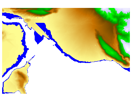
This digital elevation model (DEM) was developed from 1:12,500 scale maps of the Kingston Metropolitan Area. Contour intervals for the elevation values are 25 ft in low lying areas and 100 ft in hilly areas. This DEM was developed as part of the seismic hazard assessment. Two images of this DEM--planimetric and orthographic--are shown below.
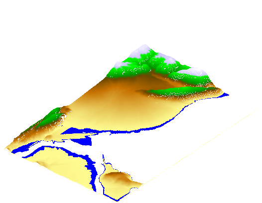
Orthographic View of Kingston 1:12,500 Digital Elevation Model
| CDMP home page: http://www.oas.org/en/cdmp/ | Project Contacts | Page Last Updated: 20 April 2001 |