Wave Hazard Assessment for Selected Sites on the West Coast of Dominica, West Indies


| Back to: Wave Hazard Assessment for Selected Sites on the West Coast of Dominica, West Indies |
Back to: | |
|
The behavior of storm surge and waves becomes more complicated as they approach the shore. The waves near land are molded by the shape of the shore in each location, both in plan and in profile.
As storm surge and waves collide with a shallow bottom, momentum and mass continuity cause the water to pile up. A countervailing effect is the loss of wave energy due to friction and deformation in shoaling water. There are five basic components of a storm surge, caused by various processes in a storm event, plus the normally occurring astronomical tide:
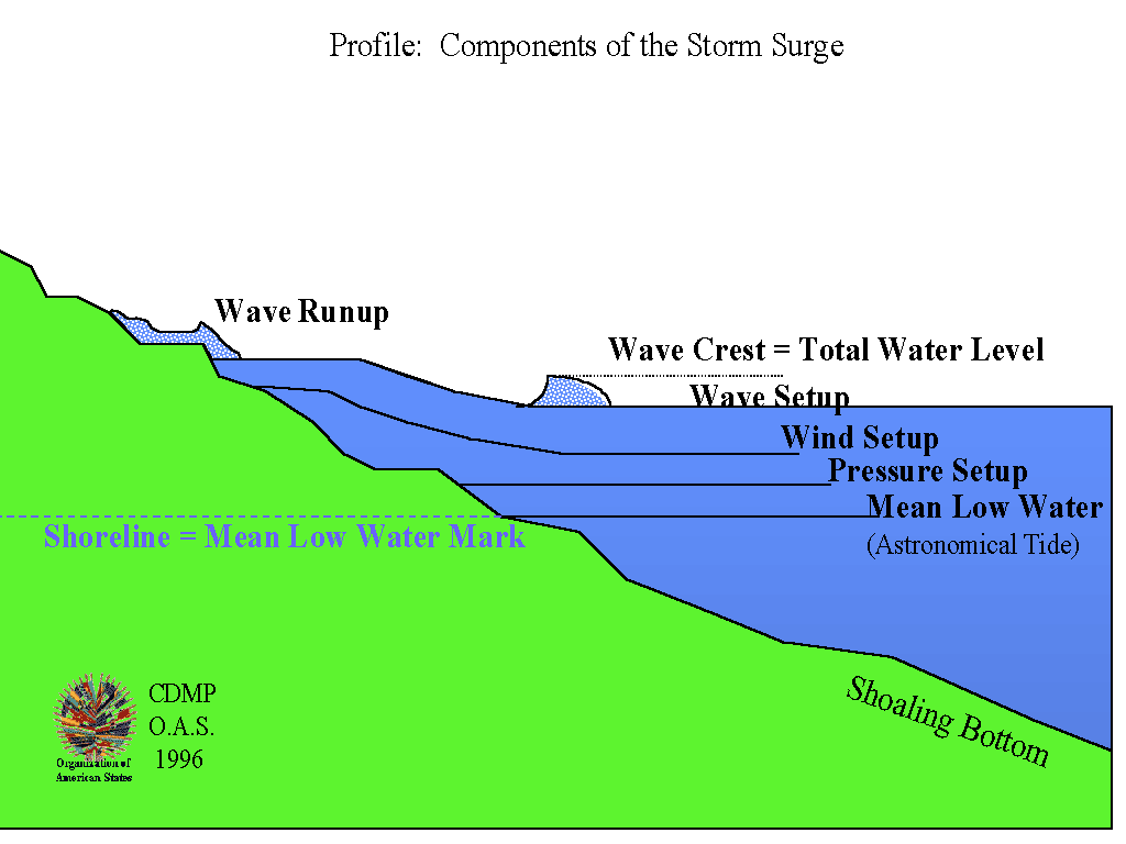
These various effects run over the shore and onto the land to various degrees. In order to have a standard shoreline for reference, it is customary to refer to the height of storm surge and waves vertically above the mean low water mark. In addition, it is considered conservative to estimate these effects as if the storm arrived at the same time as a, normal, average high tide.
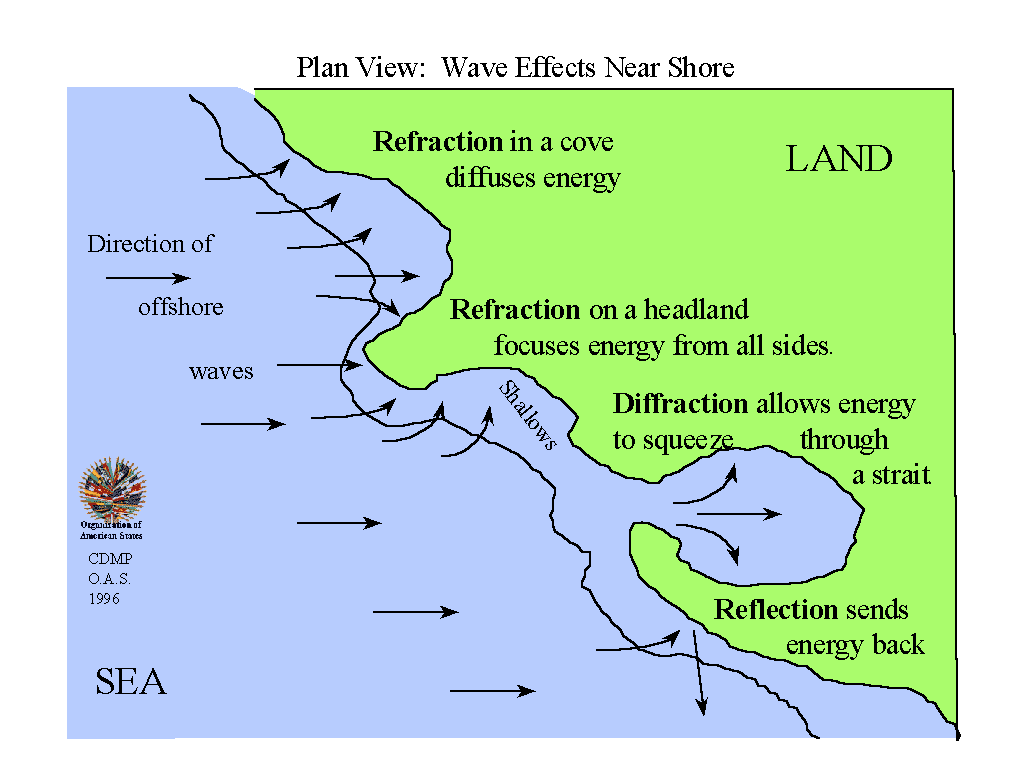
The wave energy also changes direction, due to refraction, diffraction, and reflection.
These processes are not perfectly efficient; some energy is lost in any refraction, diffraction, or reflection. It is this lost energy which grinds stones to sand, tears down cliffs, and smashes sea walls.
All these local effects are especially accentuated along a rocky, indented shoreline such as the west coast of Dominica. Headlands have the waves refracted around them, so that there is surf on all sides. Coves allow the wave energy to spread out. Deep water near shore allows waves to come close before they start losing energy, and steep beaches get the impact of waves that must be reflected or absorbed.
Because these effects are so extreme on Dominica, extra care was taken to have detailed information on the shape of the shore and shallows near shore. TAOS and HURWAVE used 4-kilometer finite elements for the open ocean, changing to 1-kilometer cells nearer to the islands, and feeding the storm parameters into 100-meter cells ringing the coast. These models used full primitive equations derived from fluid dynamics to calculate wind shear, mass conservation, momentum, and the other physical processes of the storms.
Inside the ring of 100-meter finite elements, the WES spectral wave model took the storm parameters and calculated the same physical processes for cells only 20 meters wide. The model required a high-resolution spatial model of the shape of the shoreline and the shape of the bottom near the shore. A large, detailed digital map of the entire west coast of the island was produced for this purpose.