Wave Hazard Assessment for Selected Sites on the West Coast of Dominica, West Indies


| Back to: Wave Hazard Assessment for Selected Sites on the West Coast of Dominica, West Indies |
Back to: | |
|
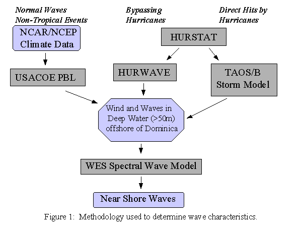
It was necessary to separate wave effects in deep water from the more complicated interactions of sea and land which occur in shallow water.This study used several different methods to determine offshore wave parameters.
To determine the characteristics of waves in the near shore region, the outputs of the programs listed above were used as inputs to a spectral wave model developed by the US Army Corps of Engineers Waterways Experiment Station (WES). The WES spectral model was run to produce more detailed data for the area near shore, a resolution of 20 meters per cell. This fine resolution was desired because the characteristic rocky coastline of Dominica was expected to produce extremely localized storm effects.
The normal tide range for Dominica is relatively small. Using data from June 1969 to May 1970, NOAA determined that the tides are chiefly diurnal with a mean range of from +0.16 to -0.20 meters msl, with a highest observed tide of 0.49 meters and a lowest tide of -0.37 meters. Given the short observation period, a model run was made using the University of Texas tide model (see references). This model produced results similar to the NOAA data, and a tide range of +0.20 to -0.28 meters msl was used for all modeling runs.
For the lee side of Dominica, normal wave amplitudes are generally small. A model run was made using the climatalogical mean winds from the NCAR reanalysis project. Given refraction, normal waves are less than .5 meter in height with a period of 12 seconds. With such small amplitudes of both tides and waves, there was no need to model near-shore hazards. No maps or inshore data are provided for the normal wave climate in this report.