

Drought hazard assessments have been completed for Antigua, Barbuda and Nevis. Both Technical and Summary reports on these hazard assessment are available by country and maps are available for each island. Individual drought hazard maps will be produced for each island. The scope of work for this activity is described in the drought hazard assessment terms of reference.
| Antigua and Barbuda | Nevis | |
| Summary Report | Antigua/Barbuda Summary (HTML 30k) | Nevis Summary (HTML 32k) |
| Technical Report | Antigua/Barbuda Report: Acrobat format (955k) | MSWord format (325k) | Nevis Report: Acrobat format (935k) | MSWord format (305k) |
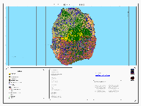
| Drought Risk Map |
Antigua Map: Medium
detail (HTML 70k) | Higher
detail (Acrobat 280k) |
Nevis Map: Medium detail (HTML 75k) | Higher detail (Acrobat 740k) |
| Drought Risk Data |
Antigua shapefile (zip
archive 15k) Barbuda shapefile (zip archive 55k) |
Nevis shapefile (zip archive 7k) |
| Other GIS Data |
Antigua landuse shapefile
(zip archive 250k) Barbuda landuse shapefile (zip archive 101k) Antigua shapefiles:
watersheds, roads and contours (zip archive 340k) |
Nevis
landuse shapefile (zip archive 60k)
Nevis shapefiles: water resources features (zip archive 6k) |
Related Links: US National Drought Mitigation Center (University of Nebraska, Lincoln) | Drought Hazard Mapping Chapter of OAS Primer | United Nations Secretariat of the Convention to Combat Desertification
| USAID/OAS Post-Georges Disaster Mitigation: http://www.oas.org/pgdm | Page last updated on 07 May 2001 |